Saturday 31 December 2011

Happy New Year

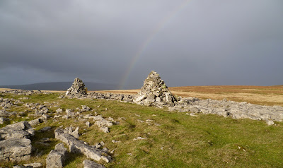
Sunset over the Paps of  Jura

So we bid goodbye to 2011 and welcome 2012. Best wishes to all for the New Year, be you walking or on two wheels enjoy your Outdoor World!
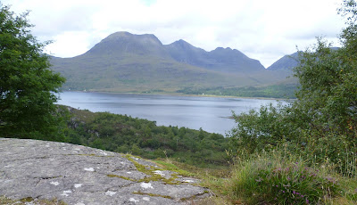
Dawn from Silver Howe

Tuesday 27 December 2011

Byways by Bike

Dollywood Lane
A rather dull and damp day today gave me a chance to catch up on a few jobs. However by 2pm things were looking a bit drier, and with daylight at a premium  I ventured out on the rough-stuff bike to ride a few lanes locally. I left Holme by Old Lane picking up Hangbridge Lane and after crossing the A6 rode through Beetham. The short climb to Slackhead and after a few hundred metres I took to the byway of Dollywood Lane, everywhere is very wet but this lane has a good stoney surface. The end of the lane brings you to Hazelslack Farm and its adjacent old tower, I turned right along the lane to Storth. For a change I branched off on the back road from Sandside past the huge renovated limekilns, onwards across the Milnthorpe Marsh, the dykes all full trying to drain the fields. Back across the A6 to ride up Grieveson Lane, another byway. This would have been better ridden down, it was very muddy, a lot of pushing was required! Breathing returned to normal once on the tarmac at Mabbin Hall, the rest of the ride was on quiet lanes. I made a detour on the way back via Nook and Farleton, the rain had held off for the hour and half I was out, the fresh air is always welcome.

Monday 26 December 2011

Boxing Day Amble

Cairns on Hutton Roof Crags

Limestone pavement
A walk from home, following the Lancaster Canal south before crossing the M6 and taking the footpath into Curwen Woods. The path heads across a large area of limestone pavement, much of it has been robbed out but there's still a lot left to see, thankfully protected. A short bit of metalled road then southwest along a bridleway which gave access to the Cumbria Wildlife Trust reserve of "Lancelot Clark Storth,"(wonderful name). A steady climb through the reserve amidst hazel, ash, oak and yew all growing on the outcropping limestone brought me onto the confusing plateau of Hutton Roof Crags. I visited the prominent cairn, although this isn't the summit, that lies to the south (Ploverlands a Marilyn). The wind was gusting strongly so my plans for lunch at this point were posponed. I headed north along the broad ridge, crossing the road and once sheltered by the tall limestone wall I had my turkey butties. Onward to the summit of Farleton Knott, with the wind battering me, I was pleased to drop down and make my way to the bridleway and Holmefield, just a short way and I was home.

Sunday 25 December 2011

Merry Christmas

A rather more seasonal scene than we have at the moment!
                 Wishing all who follow or merely pop by for a browse a very Merry Christmas!

Saturday 24 December 2011

RSF ride from Halton

Bridleway below Caton Moor
A short mainly tarmac ride from the home of the South Lakes group RSF. From Halton, near Lancaster we rode along the Lune Cycle path to just beyond Caton, uphill was the order of the day as we climbed through Brookhouse beside Bull Beck. Quarry Road took us onto Caton Moor and a height of over 250metres, the view from here would be excellent on a better day, albeit blighted to the south by a wind farm. Apparently one of the first in the country dating from 1994, if only we knew then what we know now! Down hill on the rough bridleway past the clay quarry's which serve the brickworks at Claughton. Then a short lane to Farleton, followed by a short section of the busy A683 road before we branched off to Wray riding along the rather muddy "Back Lane" which brought us into the village. The tearooms at Wray Bridge beckoned, fortified by cake and coffee, (or chips in Ian's case) the ride led through Hornby and across the Lune at Loyn bridge. All road work via Eskrigge but bypassing Aughton. The weather had been a lot better than the forecast, with no rain whilst we were riding.

Sunday 18 December 2011

RSF ride round Kentmere

Coniston Fells from above Brow Foot


Three Wise Men.........Ermm!
Once again we met in Wilf's Cafe in Staveley, after cakes, coffee and a chat, and a final decision on our route for the day. This was determined by the heavy frost, which meant we should keep to tracks and bridleways as much as possible, the theory being "more grip!" We rode up past Brow Foot and turned right onto the bridleway which led round into Kentmere Park. The track had alot of ice and frozen puddles, I decided to reduce the pressure in my tyres, which may in hindsight have been an error, as within half a mile or so I had a puncture! This meant my colleagues had a good chance to look at the amazing views, plus some Red Deer in the foreground. We continued to Park Beck where we had lunch sat in the sun. Round the corner past Whiteside End we were treated to the eastern arm of the Kentmere Horseshoe which was plastered in snow. Down to Kentmere Hall, a fortified farmstead, managing to avoid the icy patches, then on to the church which always looks a bit plain to me. A short leg down the valley road, then up the bridleway at Longhouses, which was largely unrideable until it levelled out below Green Quarter, this is a lovely quiet area. Well on our way back now we descended past Park House before taking the short bridleway at Elf Howe to the valley floor. Only a few hundred yards from here to Staveley and coffee and tiffin in "The Cakery," highly recommended!
Kentmere

Sunday 11 December 2011

RSF ride from Carnforth

The Old Rectory, Warton

Our meeting point today was the Refreshment Rooms of "Brief Encounter" fame At Carnforth railway station, the weather didn't look promising. I had ridden down to Carnforth in heavy rain, but after we'd had a coffee the rain had stopped. Most of todays ride was on the tarmac, we called and had a look at the 14thC Old Rectory in Warton. After our lunch on the shore at Silverdale we rode the bridleway over the shoulder of Arnside Knott. The rain set in again so we called in to "The Old Post Office" tearoom in Beetham for cake and coffee. Fortunately the rain had eased off, our route took us up through Slackhead , down to the mosses near Hale, I said goodbye to Simeon and Norman at Tarn Lane and made my way home.

Wednesday 7 December 2011

Thin End of the Wedge?

Here's a link to the news which I heard today on local radio .http://www.thewestmorlandgazette.co.uk/news/9406498.Kirkstone_Pass_Inn_wind_turbine_application_gets_go_ahead/     As you can see, there were mitigating circumstance's put forward by the current landlord. But I would suggest this application was rather low key, I listen to local radio whenever I'm in the car and I can't remember hearing anything about this until this week. The Wind Turbines are to be 15metres high, I guess these will be very visible from Red Screes, and to a lesser extent from elsewhere. The pub and the car park (Nat Trust) are in some peoples minds an eyesore anyway.  Perhaps of more concern, as far as I'm aware, other than odd turbines on individual properties, these are the first free standing turbines in the LDNP. How long before the slate mine at Honister puts in an application? A sad day for the Lakes I think.

Sunday 4 December 2011

Sour Howes

North from Sour Howes
This quite a regular walk for me, Sour Howes from the Moor Top Road. It's an old favourite going right back to schooldays, the area holds many happy memories. Dubbs Road is an easy walk past the recently repaired Dubbs reservoir, the track then climbs until the Troutbeck valley comes fully into view. Today the fells had the first significant snowfall on them, it'll take a bit more before i'll be out on the ski's or snowboard though! A steep stile gives you access to the open fell, it's quite steep as the path twists and turns ever upwards onto Applethwaite Common. I was soon on the summit of Sour Howes, or at least one of them. I visited the other bumps, before continuing along the broad ridge towards Sallows, I didn't visit the top, I've been there many times before and knew the ground would be very wet. I dropped down to the Garburn Road to be greeted by a terrific snowstorm, it didn't last long, and in-fact stayed dry all the way back to the car.

Sunday 27 November 2011

Ingleborough

Trig and shelter on Ingleborough

One word sums up today's walk, "Wild." I parked on the high point of the minor road between Ingleton and Clapham, this road forms the southern edge of the Yorkshire dales National Park. There is no right-of-way on to the open fell from this point but access is tolerated. A good path leads up through boggy ground, until the limestone is reached when things dry up a bit. Beyond "Grey Scars" it becomes rather wetter underfoot, "Little Ingleborough" and Ingleborough are clearly in view ahead, the path leads up and eventually onto the broad ridge.  The wind was very strong making sensible walking all but impossible, once I was in the lee of the summit plateau there was a bit of shelter. However as I popped onto the plateau I was subject to the full force of the north-westerly gale, progress was very slow as I inched towards the trig point and summit shelter. Just to top things off a shower greeted me, I didn't hang about long. A couple of photos were snatched, I jogged back down the way I'd come over "Little Ingleborough" and down towards the limestone of "Grey Scars." It was a bit of a battle against the still strong wind, once on the scars I had a mootch round the various sinkholes and potholes in the area. I was treated to a rainbow, then walked the short distance down to the car.
Cairns on Grey Scars

Thursday 24 November 2011

Nicky Nook

Trig on Nicky Nook
This was a re-visit to the Grizedale valley, near Scorton on the western edge of the Bowland Fells. I had been here for the first time with the RSF on the bike about a fortnight ago. Today I was walking, we followed the Grizedale valley up to the reservoir, were we had lunch. The next leg of the trip was all new to me as we followed the footpath up to the trig point on Nicky Nook. Who could resist a hill no matter how high with a name like that. This small hill sits back from the bulk of the Bowland fells, and as is so often the case the view is all the better for it. Out to the Irish Sea things were sadly a little hazy, but inland things were far clearer. The wind had really got up so we didn't linger long and followed the path north-westwards to reach the minor road which skirts this little hill. The path was very muddy it looked like a herd of Water Buffalo had been driven up it, although I doubt that was the case! The minor road led us unerringly back to the car, a really pleasant stroll.

Sunday 20 November 2011

RSF ride from Staveley-in-Cartmel

Swans on Sow How Tarn
Today was spent in the murk, the fog/mist persisted all day which was a shame. Although the ride was organised to start from Staveley-in-Cartmel, because I was riding from home I arranged to meet Simeon at the "Hat Trick Cafe", Low Newton. Only one other member was in attendance, after coffee and cake in the cafe we rode down to Staveley and walked up the bridleway into Chapel House plantation. With most of the days height gained, the track led us past Simpson Ground reservoir and down across the allotment. Foxfield then Sow How were passed before we descended again to Sow How Tarn, lunch was taken overlooking the tarn. Widdle Tarn was seen by a short walk from the bridleway. Another descent followed by a sharp climb to Lightwood, and after a couple of hundred metres we were on tarmac for the first time since Staveley. The narrow lanes continued northwards along Cartmel Fell, the dull day meant we were going to run out of daylight so we altered our plans dropping down to Roper ford. The Winster valley was the way back, it made sense for me to break off early returning home via Witherslack, Beck Head, High Sampool, Milnthorpe Marsh and Milnthorpe.

Thursday 17 November 2011

The "Isthmus" Derwentwater

Catbells from the "Isthmus"
Merely a stroll under heavy skies from Keswick out to the "Isthmus" on the shore of Derwentwater, followed by a good browse round the many gear emporiums that Keswick has to offer.

Sunday 13 November 2011

RSF ride from Cafe de Lune, Conder Green

Shorts in November, Madness!!
Out with the Rough Stuff Fellowship again, this time south of home. The meeting place today was at Cafe de Lune at Conder Green, and very busy it was too. For those readers who are unsure of the whereabouts of Conder Green, it's a couple of miles south of Lancaster on the Lune estuary. Our ride today was mainly on the road on the western fringes of the Bowland Fells. The area is criss-crossed by a network of quiet lanes through rolling terrain.The route led us to Galgate, before climbing to Abbystead and crossing the River Wyre to reach the unfenced fell road. Onwards and onto our first bridleway, this was only quite short, it did contain the small ford in the photo above. More lanes and we picked up the next and indeed final bridleway which took us down Grisedale. We stopped for lunch beside the reservoir, before descending the rest of the bridleway, then roads to Scorton. A visit to "The Barn" for coffee and cake was in order, duly refreshed more lanes led the group back to Conder Green where we went our seperate ways. I retraced my route of the morning back home via the Lune Cycle Path, Halton and over the hill through Kellet to pick up the Lancaster Canal. A total of almost 68miles for me, in weather which was hard to believe for mid November, many of the group still in shorts!

Thursday 10 November 2011

Winterburn Reservoir

The dam at Winterburn Reservoir
A short stroll under overcast skies from the hamlet of Winterburn, located 3 miles or so north of Gargrave. Our route was up the wooded valley following Winterburn Beck, (notice a theme here?). The track is metalled, although private all the way to the reservoir. Frustratingly the right of way veers off to the left only 50 metres away from the dam. Lots of signs from British Waterways saying private etc, however a short trespass was in order to catch a glimpse of this little known stretch of water. Photo's taken, we retreated and made our way to the car by higher level field paths, getting caught in a rain shower just before we got back. I was surprised to see the British Waterway signs at the reservoir, presuming it had been built as a water supply for towns and villages in the Airedale. It was however constructed for the Leeds-Liverpool Canal in the late 1800's, canals of course use lots of water through the locks. Hence the British Waterways signs, I don't quite see why it must be off limits to the public though.

Sunday 6 November 2011

RSF ride from Wilf's Cafe, Staveley

Re-grouping nr Wads Howe in Longsleddle

The weather today was magnificent, I chose to ride from home to Staveley to meet Simeon and the Welsh Border Group who were having a weekend in the Lakes. There was a lot of us and the service in Wilf's was a bit slow so it was 11ish by the time we got underway. We headed off up Kentmere, taking in a couple of short lanes which took us up onto the High House minor road. Beyond High House this becomes unsurfaced and climbs gently up through a number of gates to give access to the open fell. The route took the southernmost bridleway across the open moor, the going a bit boggy to start with but it improves and then descends into Longsleddle. This is one of the quieter valleys, always a joy to visit. The west side of the valley has a little used track/bridleway, we stopped part way along this for lunch sat in the sun until it disappeared behind the hill. Garnett Bridge was our turning point, the minor road took us back up the valley to Sadgill which is the start of the Stile End track. This is rather steep and not that welcome near the end of the day! Of course for every up there's a down and a quick descent was made down to the Hallow Bank road. A puncture had to be repaired at this point, after that an easy ride down Kentmere and a visit to "The Cakery" brought the day to an end. Our Welsh Border group visitors seem to have enjoyed the day, having seen the Lakes at its very best. The day wasn't over for me, I had the 15 or so miles to ride back home. The lanes were very quiet and with a bright moon it made for an enjoyable last leg.    
West end of Stile End track

Thursday 3 November 2011

Grasmere Circuit

Weir at Grasmere
Leaving the car near White Moss, we dropped down to the River Rothay and walked up the northern bank through Penny Rock Wood to the footbridge adjacent to the weir at the outflow of Grasmere. The trees still had a good few leaves on and the autumn colour were lovely. Almost everyone we met was snapping away, our route followed the shoreline round to Hunting Stile. Along this section we stopped for lunch looking out over the lake, suitably refreshed we continued, the road led us into Grasmere village. A bit of gear browsing then out on the return leg past Dove Cottage and back to the car. The sun had shone to start, but the cloud had increased during the day so we counted ourselves lucky.

Sunday 30 October 2011

Oddendale

Autumn at Oddendale
A wild walk east of Shap, having parked beside the plantation of Castlehouse Scar we headed through the plantation and on to the low ridge. This has several antiquities on it, a cairn and a cairn circle, both were visited. The circle is composed of Shap Granite boulders, there are many erratic's in the area so they would certainly be handy for the circle builders. The footpath enters a walled lane, and this bridleway takes you across the fell to "Oddendale", several homesteads and a working farm. This must be a bleak spot in winter, confirmed after a chat with one of the residents. The route led us down the shallow valley to "High Dalebanks", here a path took us upward via the farm of "Haber". This was a desperate spot, an air of decay, desperation and vicious chained up dogs. My advice to anyone walking this way is BEWARE! Ascending a good track "High Haber" was soon reached this was a barn conversion to eco-home which looked like it had run out of money, a shame as it occupied a grand location.Just a simple walk back over the low ridge remained to bring us back to the car.

Sunday 16 October 2011

RSF ride from Low Newton

Bridleway at Low dale Park
A great day out with the RSF, we met at Low Newton at 10am, our target the low fells south of Grizedale forest. A better turnout than my last ride out with the South Lakes group, seven of us in total. The "Hat Trick" cafe was closed so we rode down to the "Mallard" cafe for our morning cake stop. Cake consumed we rode by Beckside and Bigland before dropping down to cross the river Leven to Haverthwaite. Onwards across "The Causeway" to Bouth. An old County Road took us over to Colton, lunch was taken near the top looking out over the Rusland valley. Then on a bridleway to High Ickenthwaite, and a descent to the valley floor at Force Forge. Crossing to Low Dale Park another bridleway up and over to Field Head, then down the road to Lakeside for the afternoon cake stop. Having watched the lake steamer "Swan" arrive and depart, we cycled mainly on the cycle path back to our cars at Low Newton. For anyone wanting to know more about the Rough Stuff Fellowship, lots of info can be found at http://www.southlakesgroup.org.uk/index.html

Thursday 13 October 2011

The Settle Loop

Scaleber Force
A daywalk from the end of Mitchell Lane, just east of Settle. The plan was to walk a couple of the bridleways between Settle and Long Preston, some of these form part of the Settle Loop of the Pennine Bridleway.Lambert Lane and High Hill Lane led us to Scaleber Force which was in spate and made a grand sight. Back on our route Langber Lane was a surprise this byway has a tarmaced surface, certainly as far as Book Gill Beck, but seems to be very rarely used by vehicles. We followed the beck and eventually arrived on Edge lane. After a break on a handy seat sat in the sun we followed the lane across the low moor back to the car. A splendid walk on mainly new terrain.

Thursday 6 October 2011

Foulshaw Moss

Across the moss's
This is an area of raised bog just south of Whitbarrow Scar on the edge of the Lakes. Although close to home I had never explored this reserve, which is managed by the Cumbria Wildlife Trust. The permitted path, much of this is on boardwalk to protect the bog is only short, but full of interest and worth an hour or so of anyones time. Unusual terrain for the Lakes, similar to Roudsea, for those who know it!

Thursday 29 September 2011

BMW North York Moors & Whitby

Whitby Abbey from West Cliff
Another beautiful day, really warm. I got an early start and rode over to the North York Moors. From Thirsk I went via Boltby, Ryedale, Helmsley, Farndale, Rosedale and Egton Bridge to arrive beside the seaside at Whitby. The dales were nice and quiet, but by contrast Whitby was awash with folk. The beaches looked like a summer sunday, some people were swimming in the sea! My return route led via Sandsend, Danby, Kildale, Stokesley, Cattrick and Wensleydale. The sun retained its warmth almost until I arrived back home just as it was setting. Its a shame I hadn't been able to get across to the moors a few weeks earlier to see the heather in full bloom, its always a magnificent sight.

Sunday 25 September 2011

BMW Alston & Teesdale

Lunch spot.
Taking advantage of the excellent day, because there probably won't be many more suitable for riding the motorbike in comfort. I rode over to my favourite area of the north pennines, crossing Hartside pass to Alston and travelling south to Teesdale, before crossing back to Brough on the western edge of the Pennines. The route then took the more direct way through Kirkby Stephen and Sedbergh. The sun shone for much of the day, and a very lazy lunch was taken on a bench beside a minor road high above the Tees.

Friday 23 September 2011

Bloggin & Gear Reviews

Ok, so those of us who read a number of outdoor Blogs, lightweight and otherwise, will more than likely have read http://www.andyhowell.info/trek-blog and andy's thoughts on reviews of gear. I am at one with Andy's thoughts on this. I've got to say the chance of me being loaned/given any gear for review are scarce indeed. Anyone who visits this blog will be well aware that there is little in the way of gear testing reported here! I like most am a sucker for the latest and greatest bit of kit, but find that most of it, with odd exceptions doesn't add to the experience but often removes one from it. To be honest I'd rather be out there doing it than sat at home writing about it. My two days off each week are precious time to be spent in the outdoors. Much of the gear I use is no longer made, but is every bit as good as the new stuff, there's almost always a trade off! Doesn't mean I don't like reading about new stuff mind! Back to the point, I'm glad Andy has raised this issue, any reveiw must be transparent to give it any value at all to those out there who are just getting into this outdoor world. Wow that was a bit of a rant!!

Thursday 22 September 2011

Skelwith & Owlets Nest

Lingmoor Fell and the Langdale Pikes from Elterwater
A gentle ramble from Skelwith Bridge, past Skelwith Force and turned south along the Cumbria Way. After visiting Colwith Force, the next point on the walk was the renewed bridge adjacent to the ford in Little Langdale. Following the metalled lane to the B road which leads eventually to Wrynose. Our route turned right to cross into Great Langdale via Owlets Nest ( a wonderful name), descending to Elterwater in the afternoon sunshine, the trees a marvellous range of colours. The way back to the car was the path beside Elterwater and the Brathey river.

Sunday 18 September 2011

RSF ride from Tebay

Climbing up Orton Scar
This was my first ride with the Rough Stuff Fellowship (RSF). For those who aren't aware the RSF pre-dates modern mountain biking by more than 20 years. The big difference is that it's no shame to walk and indeed being out in the countryside is the important bit. There were three of us today, our ride took us from the tearoom in Tebay along the old road to Gaisgill, where we crossed the "new"road. Heading roughly north we reached the first bridleway which took us past a stone circle, and climbed up over Orton Scar and down to the ancient pile of Gaythorne Hall. Back up over Westgill Head and down towards Crosby Ravensworth, stopping en-route for lunch. We looked in the churchyard at Crosby Ravensworth to fin and photograph the gravestone of the lost cyclist. Our bridleway led us up to Oddendale farm where we turned left and crossed the moor to bring us to the edge of Orton. Coffee and cake were taken at the chocolate shop before minor roads and a short bridleway brought us back to Tebay. I throughly enjoyed my day and looked forward to the next outing.

Thursday 15 September 2011

BMW Hawes & Kettlewell

Across Wensleydale from nr Thornton rust
A short but pleasurable ride down Wensleydale to Aysgarth, were the falls were nicely full after our rather wet spell. Then over to Kettlewell via West Burton and Buckden. Back home through Grassington, Airton, Settle and Kirkby Lonsdale. Trees are really turning now, there's quite a chill in the air first thing, indeed only 2 degrees in Shap according to the radio this morning. It was great to sit and have lunch in the sun and simply chill out.

Monday 12 September 2011

Eaves Wood and New Barns Bay

Not the day I thought it was going to be! Weeks ago I had booked today as a days holiday so that I could watch "The Tour of Britain" cycle race, however due to the arrival of the remnants of hurricane Katchia the Kendal to Blackpool stage was cancelled. At 10.30am on Grayrigg common this was entirely understandable, it was all I could do to stand up! So plan B was a walk in the relatively sheltered area of Arnside and Silverdale. I had met a friend Ian here and a modest walk was taken through Eaves Wood, past Arnside tower over the shoulder of Arnside Knott and down to New Barns Bay. The warm moist conditions recently seem to have produced a great selection of fungi. Our return route followed the shore, the wind terrific whipping up huge waves in what is after all an estuary. Field paths and the bottom of Eaves Wood brought us back to our cars.

Sunday 4 September 2011

BMW Wrynose & Hardknott

Southern Fells from Birker Moor
A short ride on the motorbike over the passes as above. Everywhere remarkably quiet considering the superb weather, which was rather against the forecast. The bracken is at last starting to die off, the trees are not far behind. The all pervading green will soon give way to the orange's and russets of Autumn. I had lunch beside the Birker Moor road, with a fantastic view over the Southern Fells.

Thursday 1 September 2011

Austwick & Wharfe

Austwick Beck and Moughton scar
 A walk by accident! The original plan was to walk some more of the Leeds Liverpool canal, but the weather was so good that we wanted to be out of the car as soon as possible. An easy stroll round the bridleways and footpaths between Austwick and the hamlet of Wharfe. We saw lots of wild food in the hedgerows and lots of farm animals in the fields. This is another relatively quiet area away from the honeypot favourites in the main part of the dales. The big surprise was the weather, forecast to be overcast, the sun shone virtually the whole time we were out.

Sunday 28 August 2011

Potts Beck & Little Asby

Potts Valley, looking East
Bank Holiday weekend so once again time to search out solitude for a stroll. The quiet area round Little Asby, provided a suitable trip, although quite close to the coast-to-coast we only saw two people at a distance! The Potts Valley is home to naturally enough Potts Beck. Unusual in that it contains a beck at all, for this is limestone country. The heather on the fell round Sunbiggin Tarn was magnificent, when the sun caught it. It would have been a warm day if it wasn't for the strong north wind, I wore a Paramo, all day in August!

Sunday 21 August 2011

Giggleswick Scar

Only a short walk but full of interest. The inquisitive walker will see caves, ancient cairns (and modern ones), springs, a disused limekiln, old reservoirs and at this time of year lots of fungi and wild flowers. The view from "Schoolboys Cairn" is excellent, Giggleswick and Settle nestled under the many knolls of Attermire Scar.

Thursday 18 August 2011

BMW West Highland Tour Day 5

Back home today, avoiding motorways as much as possible. Tummel Bridge, Kenmore, Amulree,Creiff, Glen Eagles, The Clackmannanshire bridge, Falkirk, Avonbridge, Harthill, Forth, Carwath, Biggar, Moffatt then the old A74 now B6076 to Gretna. From Calisle the A6 was the route home. This made as straight a line as possible from Aviemore, (inspired by Nick Crane's "2 Degrees West") which I've been reading this trip. Not the quickest but far more interesting than the sterile corridors which are our major highways

Wednesday 17 August 2011

BMW West Highland Tour Day 4

Beinn Alligin
A lot of miles today, great roads, great views and not many people. My route took in Invergarry, Dornie,Loch Carron, Bealach na Ba, Sheildaig, Torriden, Kinlochewe, Inverness, Glen Kyllachy (a hidden gem) and ultimately Aviemore. Lots of favourites here, I would have liked more time on this leg but the available hostels didn't allow it. Aviemore was heaving with people, once I got provisions I didn't venture out.

Tuesday 16 August 2011

BMW West Highland Tour Day 3

This day was always forecast to be wet and it was! Very Wet! Not often I envy people in there cars, but today I certainly did. Ever the optomist I crossed the Corran Ferry and made my way to Strontian. Sheltering in the cafe didn't help it continued to sheet it down. I wanted to look at the old mine workings, but that was out of the question, so continued over the hill and down to Pollach, not a road I'd want to do on the pushbike. I retraced my steps (or Wheels) and made my way to Glen Nevis hostel via several mugs of hot chocolate in Morrisons. No photo today, says it all really!

Monday 15 August 2011

BMW West Highland Tour Day 2

Standing stones at Kilmartin
The plan (such as it is) for this trip was to use roads and visit places that I hadn't been to at all, or at least since I was a child. With this in mind I left Inveraray crossed over to the eastern shore of Loch Awe and followed the minor road until I was almost at Ford. Just before Ford I stopped at the information board for the forest drive over to Loch Fyne. All new to me, with great views from the high point. Next on the agenda was Crinan Ferry and close by some of the Cairns and Standing Stones at Kilmartin. I then rode to Cuan Ferry, the crossing for the Island of Luing. Luing was great, probably better discovered by bicycle, due to its size. It like Easdale and Seil is one of the "slate" islands, due to many years or quarrying. Oban youth hostel was the accomadation for the night. Recently refurbished, but for who? The "self-catering" kitchen is tiny and poorly designed, I wasn't the only one who thought this either.

Sunday 14 August 2011

BMW West Highland Tour Day 1

Rainbow at Inveraray
Been a while since I've posted, the motorbike has required a new clutch, and bevel bearing! So valuable days off have been spent to and from Croston to the motorbike repairman. All this work meant I had to firstly pospone a weeks holiday and then organise something at short notice. I booked a selection of SYHA with options between each depending on the weather. Leaving home on Sunday I rode up to Inveraray trying to avoid as much M6/M74 as possible. Once through Glasgow I followed the coast via Helensburgh, and a short detour to Kilcreggan. There had been a few heavy showers in fact the photo sums up the weather

Sunday 31 July 2011

Ramble from Ormside

Fording point on the River Eden
    Today it has been very humid, I selected a route which didn't include much ascent. I parked in the village of Ormside near Appleby, the villagers were having a bit of a do. Myway lead me past the old church and hall across fields to where I thought there would be a bridge over the River Eden, alas there wasn't! I had to paddle the river, once across I had lunch before tackling many field paths to Appleby. My return path was along the Westmorland Way ( another long term project) which followed the banks of the river for most of the way back to the car.

Thursday 28 July 2011

Skipton to Gargrave

    Another walk on the Leeds Liverpool canal, Having parked in Gargrave I caught the bus into Skipton. A bit of a mouch about first and then I walked back along the canal towpath to Gargrave. Lots of brightly coloured barges, many of them for hire. It occurs to me that once control of the barge is achieved this would be a restful holiday. Anyway the sun shone for much of the day, and another section of the canal completed.

Sunday 24 July 2011

BMW Kielder

Kielder Water
      A beautiful day, I had a great day out on the motorbike to a favourite area. Kielder Forest via Langholm and Hermitage Castle. Back home through Bellingham, Haydon Bridge, Alston and Orton. Quite clear that the summer holidays have started, as everyone had brought there toys out to see the sun, Campers, Caravans, Canoes, Boats, Bikes, Motorbikes et al!

Thursday 21 July 2011

Bishop Wilton Wold

Spot the Trig!
     A round trip of 230miles to visit the top of Bishop Wilton Wold, as you can see I rode here on the motorbike, and a grand day out it was too. As you will also be able to see the trig point (just visable above the bike seat thro a gap in the hedge), is surrounded by a high fence belonging to Yorkshire Water. So like Raurden Hill I never actually touched it, but I can live with that! I travelled over via Wharfedale and back through Wensleydale, the roads quiet, before the schools break up tomorrow.

Sunday 10 July 2011

Hailstorm Hill & Freeholds Top

Hailstorm hill with its attendant windmills

       More Marilyn bagging, this time on the moors of East Lancashire. First Hailstorm Hill, which I ascended from the hamlet of Boargrave which nestles below the Cowpe reservoir. A plethora of paths made navigation tricky until above the fields. Once on the Rossendale Way the going was easy, the old quarries have had a new lease of life as a mountain bike trail. Beyond the quarries, but only a few metres higher is the summit, such as it is, only crowned with a couple of stones amid a sea of bog. All around are the dreaded windmills. I made the walk circular by continuing along the Rossendale Way, then dropping directly down to Boargrave.
        After a spot of lunch at the car I drove the few miles further east, and after a bit of trouble located the start of the path out of Shawforth. I was lucky in seeing a sign of a new permissive path which showed a beeline to the summit of Freeholds Top. Perhaps its the queues of "Marilyn Baggers", although I doubt it! I never saw anyone! The top has a small dud of water on the highest point, bizarre. Further east I could see Stoodley Pike on the Pennine way. Up and down the same way in about 45 mins, as the weather was threatening.
Freeholds Top

Sunday 3 July 2011

Cold Fell

Looking north from Cold Fell
A scorching day, ideal for flogging up pathless heather, rush and bog! This is the Cold Fell at the northern end of the Pennines, and is a "Marilyn". This is an another area I had never walked in before, pleasingly quiet and as mentioned earlier pathless. I was able to make a circuit via Brown Hill, following the fence line to the summit, which has a magnificent cairn, wind shelter and trig. Back to the car visiting a prominent nameless cairn and the few houses at Howgill. There are numerous mines in the area about which I know nothing, so swotting on the internet will need to be done! It should be mentioned that the view north into Scotland is vast, all laid out below you.

Thursday 30 June 2011

Greta Gorge

In The "Gorge"
    I must admit I have made the name of the "Greta Gorge" up! I can't really think of a better description of this area. The River Greta runs south of the A66  near Barnard Castle, it twists and turns deep in a wooded gorge for about 5km. I had never walked this before, but looked at it many times on the 1:25000 map. Today with Bill we walked down the south side of the gorge from Rotherford Bridge, downstream to Greta Bridge.                                        After lunch we walked back to the car on the north side, passing through the ancient churchyard of St Marys, near Bignall. The path on either side wasn't used very much although we did see folk on both sides. The sun shone for much of the day, tempered by a cool breeze.

Sunday 26 June 2011

BMW to Hexham Moor

Stublick Chimney
     A forecast for a really hot day meant it was time to get the motorbike out. I don't take the heat easily! I rode over Hartside to Alston and down Allendale to explore the area south of Hexham. The northern Pennines have given up great riches over the years, mineral wealth in lead, silver, and coal. I looked at many sites, mostly those which I had visited before. A new area though, Langley Mill, or rather the remains of it. The smeltmill chimney still stands at 100ft high, the flue from the mill is there if you know where to look and the chimney has its own name "Stublick".

Thursday 23 June 2011

Beinn na Lice

The Irish Coast from Beinn na Lice
Finding myself near Campbeltown on the Mull of Kintyre, I had enough time to climb the short distance from the minor road to its summit. It is an excellent viewpoint, Ireland in particular seemingly much closer than it's 12 miles away. I didn't see any "Lice", but I did see a family of Mice!

Wednesday 15 June 2011

Arnside

Arnside Viaduct
A seat in the sun overlooking the estuary. Whitbarrow Scar in the background. The viaduct still out of action due to maintainence.
  Arnside is just a handy distance for an evening ride, with lots of options for different routes.
   Best part of the day!