Well and improvement in the weather this morning had me parked under Blencathra at Scales. The cloud was just on the summit as I arrived, I hoped it would lift and clear as the day progressed.
 |
| The metalled road from Scales almost arched over with trees, hopefully they'll soon be turning colour. |
 |
| The path cutting across the back wall of Mousthwaite Comb. |
 |
| Almost at the col, and looking back towards Clough Head across the valley. |
 |
| From the col Sharp Edge comes into view. I couldn't see anyone on the path and thought I might have the ridge to myself...but this wasn't the case. |
 |
| Lots of water in the stream which drains Scales Tarn. |
 |
| I had a bite to eat beside the tarn, I knew there wouldn't be much shelter for a while. |
 |
| As I gained the ridge the hills to the North were revealed, Carrock Fell in the distance. |
 |
| The scrambling starts here, I kept as close to the crest of the ridge as possible, it didn't seem as windy as I though it might have been. |
 |
| Leaving Scales Tarn behind as height is gained. |
 |
| Fortunately I had passed a couple of guys, so I had some human models! |
 |
| A bit further on Sharp Edge, with the Eden valley beyond. |
 |
| As I left Sharp Edge and walked across towards the summit, I took the oppertunity to catch this view of the ridge from the crags above Scales Tarn. |
 |
| Looking South from the summit of Blencathra, with the sun on Thirlmere and St.Johns. To the Northwest the cloud was massing and the rain started just as I started to descend Hallsfell ridge. |
 |
| Just enough time to catch Gate Gill Top and Derwentwater. |
 |
| "The most direct way to the summit of a mountain in Lakeland" this is how Wainwright described Hallsfell ridge. |
 |
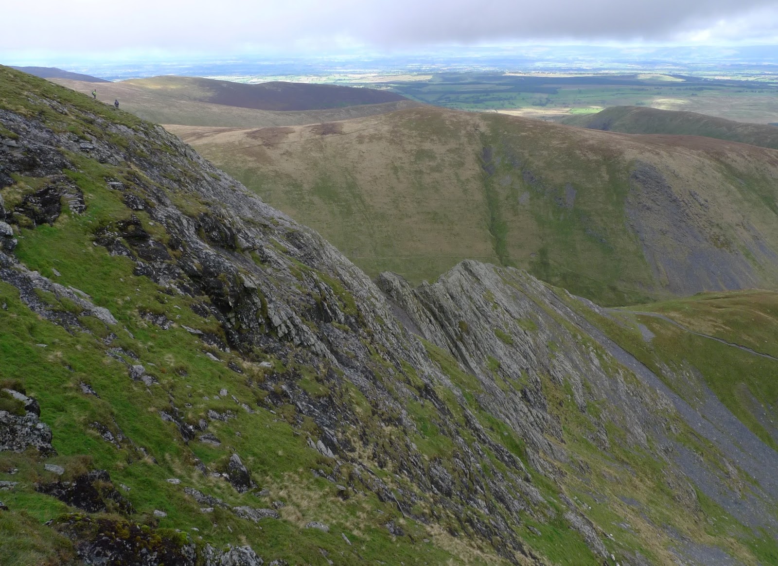
| looking back up Hallsfell ridge from about halfway, its a great way up (or down) |
 |
| At about this point the rain really came on for about 15minutes, just enough with the strong wind to give me a good soaking! Once it stopped the breeze soon dried me out again! |
 |
The foot of Gate Gill and the remains of the old lead mines. All that remained was to walk down to the old A66, which I followed to the new A66 the back to the car.
I'm not sure, but I don't think I've been up Blencathra since I completed the Wainwights for the 7th time almost 10 years ago.....it's been to long. I'll try not to leave it another 10 years! |


Ta, Al
ReplyDeleteEnjoyed that from the comfort of my settee. A wonderful airy day out
:-)
Glad you liked it Alan...a good job I got out today cos tomorrows forecast looks grim indeed!
ReplyDelete