Well the first 70 miles or so of it! Ian and I walked this in some of the hottest, most humid conditions I've experienced. Although Ian had over a number of years had walked some of this section, I have only walked an odd couple of miles here and there.
But the most vivid memory for me will be the apparant lack of use of this our first National trail. Much of it overgrown, even by rushes between the stone flags.
 |
| Ready for the off, although by now it was well gone 1pm |
 |
| The foot of Jacobs Ladder before the climb on to Kinder. We saw more people here than the rest of the walk! |
 |
| We were enveloped in mist from the top of Jacobs Ladder, a shame as I was looking forward to the walk along the edge to Kinder Downfall. Here Ian consults the map at Kinder Low. |
 |
| Kinder Downfall shrouded in mist, much like last time when I was here probably 20 years ago. |
 |
| Devils Dyke and the search was on to find water and a spot to camp. |
 |
| The following morning as we descended from Bleaklow Head the sun started to burn the mist away. The path above Torside Clough wends itsn way through the heather. |
 |
| It looked a long way down to the reservoirs in Longdendale from here. The path hugs the edge for much of the way. |
 |
| After crossing Longdendale we climbed up towards Laddow Rocks, this seemed hard work in the humid conditions around midday. |
 |
| The summit of Black Hill, this must have been purgatory before the flags were laid. But today it was an easy walk. The trig is slowly but surely slipping away, Ian is leaning in sympathy! |
 |
| After a very hot day we found a great place to camp beside Black Moss Reservoir. The humidity had built throughout the day, thunderstorms were forecast for the next day. |
 |
| Sure enough the thunderstorms arrived early in the morning. It was a wet walk over Standedge. Here we're approaching the A672, and a burger/buttie van! |
 |
| Once across the M62 we were soon on Blacstone Edge, lots of interest on this section for a Cumbrian lad. |
 |
| The trail leaves Blackstone Edge by the "Roman Road" (not actually Roman) The paving is in remarkably good condition. Lots of feet/hooves/carts must have travelled this way. |
 |
| After a refreshment at the White House pub which was very busy, the going was the easiest so far as the trail follows reservoirs and water catchment drains |
 |
| Stoodley Pike, which had been in view for a long time was eventually reached. A milestone indeed. |
 |
| A long descent into Calderdale to Callis Bridge (Hebden Bridge is bypassed!) Then a stiff climb out of the valley using lots of confusing paths and bridleways. |
 |
| It does feel like you're going against the grain so-to-speak. After the climb out of Calderdale you immediately drop into Colden Clough to cross this spendid old clapper bridge. |
 |
| Our campsite for the night was at "May's Alladin s Cave". Only available to Pennine Way walkers! |
 |
| A fresher morning and after a short climb we crossed under Standing Stone Hill. |
 |
| This Warland Reservoir and this view of a drawn down water level was a common theme throughout our time on the walk. |
 |
| In spite of what appears to be a lack of use of the Pennine Way, there were lots of new flags being laid on the section from Warland over to Withens. |
 |
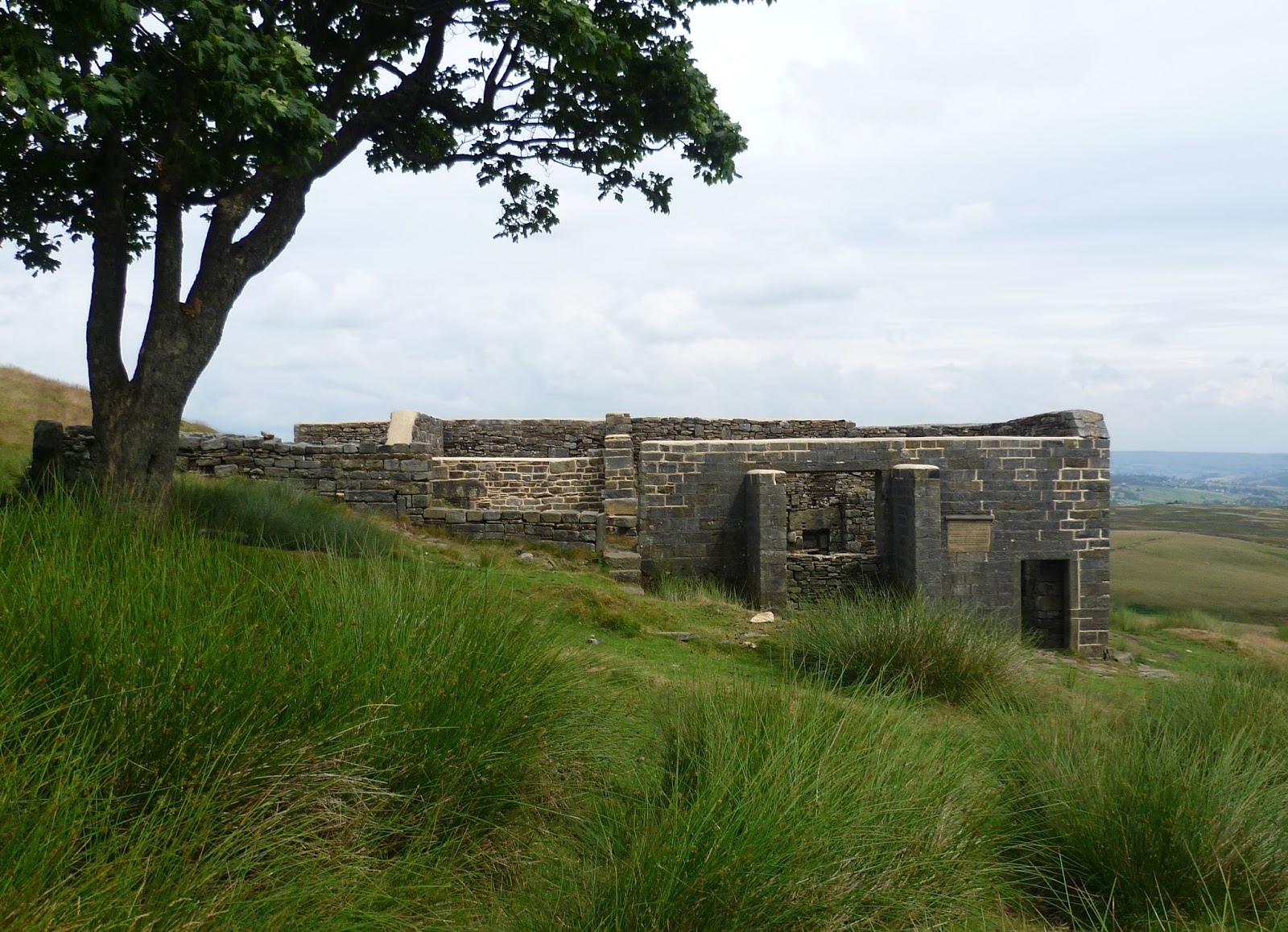
| Top Withens, and we start to see people again. Even the footpath signs are in Japanese! |
 |
| Here at Ponden the heat was incredible and once more the humidity was building. Sure enough it would rain within the hour. |
 |
| Our camp at a basic site in Cowling, shared with lots of Hen's. The brollys had kept the worst of the rain off. |
 |
| Looking back from Cowling Hill to the hillside where my father played as a child, before his family moved to the Lakes. |
 |
| The last proper hill of our walk, Pinhaw Beacon. This small hill has a cracking view, and for the old and infirm is only a short walk from the road which crosses its flanks. |
 |
| After a long gradual descent from Pinhaw, and lots of field paths the Leeds-Liverpool canal is reached. |
 |
| The famous "double" bridge at East Marton, and a bit of welcome shade. |
 |
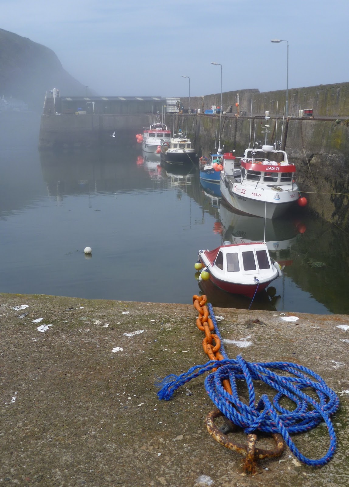
| Gargrave and the end of our walk on the Pennine Way....I'll be Back!! |