Wednesday 27 December 2017

The Greenburn Horseshoe....Grasmere

This walk is an old favourite, don't know why? It's not the longest, highest or has the best views. It is generally quiet...until you arrive at Helm Crag! Today with much of the circuit covered in fresh snow it was a cracking walk. Once more hopefully the photos do the day justice.

I only just managed to park beside the road near the Travellers Rest, taking the short cut across a barely frozen field towards Ghyll Foot and the bottom of the Southeast ridge of Steel Fell.

Its a grand walk up the ridge, pretty much direct to the top of the fell.
Across Dunmail Raise the Helvellyn range were looking splendid.

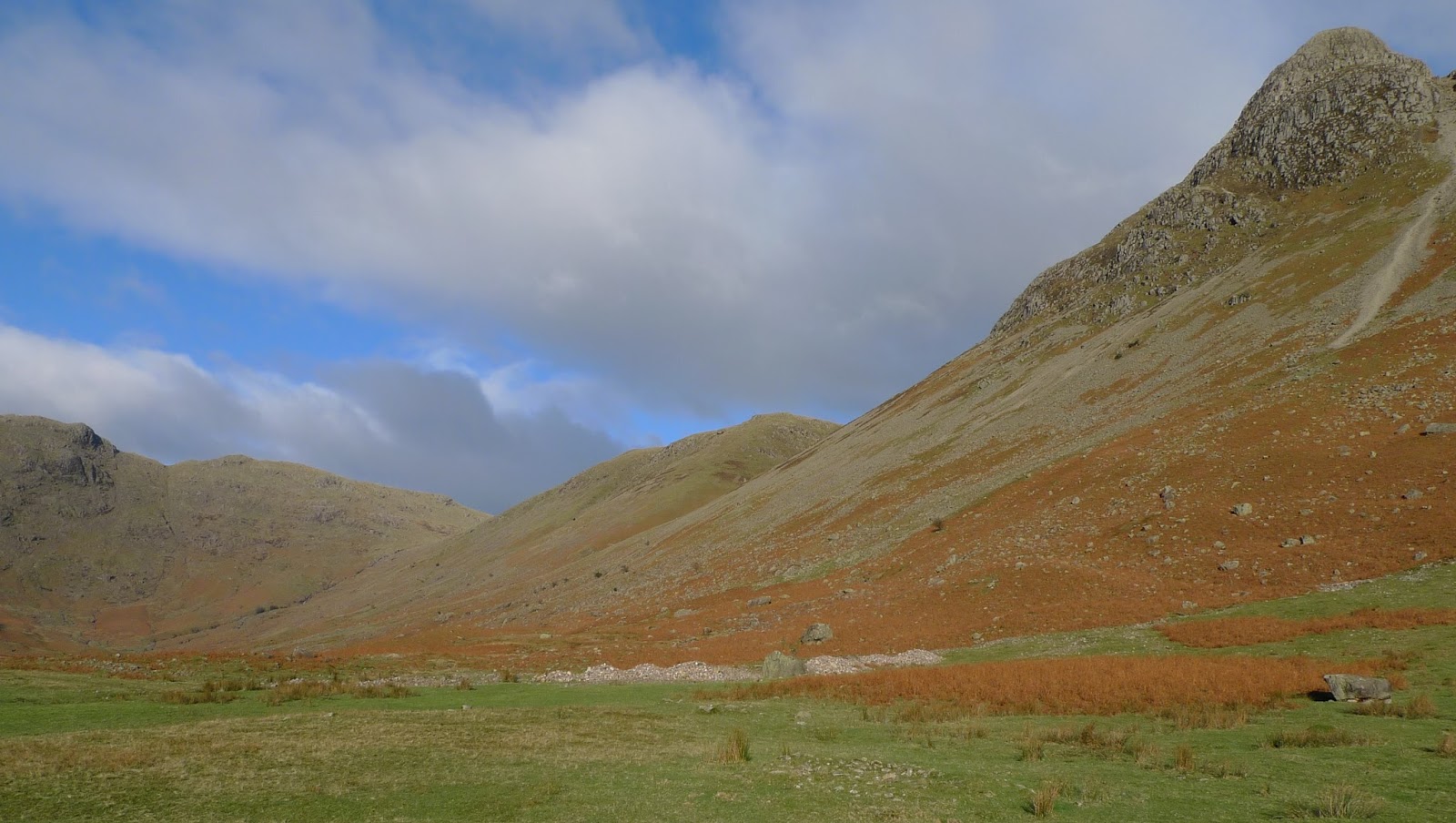
The other side of the ridge lies the quiet valley of Greenburn....it is rather wet mind!

This isn't quite the top of Steel Fel,l but IMHO it is the better viewpoint.
Helvellyn range beyond.

Rounding the head of Greenburn the ground is usually wet. Today it was in the main frozen, including almost all of this tarn. As far as I'm aware unnamed. 

The cairn on Calf Crag and the start of the return leg. Fairfield is seen to have a good covering of snow in the background.

Here the ridge is laid out before me, this image hides most of the up and downs involved mind!

Looking back along the ridge from Gibson Knott, not much snow from here onwards.
Still quite a few bumps and humps between here and Helm Crag.
Really clear views today though. 


The summit rocks of Helm Crag, here seen as "The Howitzer", sadly there was some ice on the climb to the top so I gave it a miss.
From here it was a quick jog down to Easedale and the road back to the car.

Just a few words about my footwear choice today. I wore these New Balance Goretex lined trail shoes with Inov8 mini gaitors and for some of the way Kahtoola Microspikes.
This combination worked well (as usual) my feet remaining dry throughout. The microspikes work at their best with trailshoes IMHO as more of the spikes grab due to the very flexible soles....less well on boots I find. Anyway thats my twopennyworth! 

Monday 25 December 2017

Ingleborough....A Christmas Day Hill

For the first time in 60 years I found myself able to have a "proper" walk on Christmas Day. I chose Ingleborough, handy enough to home but high enough to be interesting. I parked above Cold Cotes and took my favourite way up....although it was incredibly wet today. I only took a few photos but they should give a feel for the day.

The path is very obvious and as it rounds Grey Scars the summit of Ingleborough comes into view for the first time. Whernside is also seen in the distance on the left of this image.

The sun made an appearance as I left Grey Scars behind. Here as I crossed the flat moorland the path was at its wettest!

Just me and my shadow out today!
The sky to the North looked stormy, as I gained height the wind strenghtened.

As I reached the summit Plateau the cloud lifted, so I had a view...nice Christmas present!
It was blowing a real hoolie tho' so the pics are a little blurred.
Not surprisingly I had the top to myself, I didn't linger that long and having taken in the view....

....I walked over to the Northern edge of the plateau to look at view over towards Whernside and the Ribblehead area. I returned to the car the same way, meeting a group of 5 or so walkers om Little Ingleborough.
It had only taken 2 hours up and down, (it had stayed dry against the forecast) and I enjoyed it immensely:-)

Sunday 10 December 2017

Yoke, Ill Bell, Yoke, Sallows and Sour Howes

The cold spell continues, and after flirting with the idea of having a day on the Fat Bike I saw sense at the last moment and went for a walk. I parked near Troutbeck church and passed through Limefitt Park to take the bridleway up to the Garburn Road. Wonderful views today I hope the photographs do the day justice....

Looking across to Red Screes and the head of Troutbeck from the Garburn Road 

A little further up the Garburn Road, it occurred to me that almost 40 years to the day I fell off my trail bike here in the foreground in very similar weather conditions. I remember sitting against the wall discussing with my mate Tim whether I would be able to ride the bike home....I did and then spent 3 weeks with my leg in plaster!

Anyway onwards and upwards...I left the Garburn Road and headed up Yoke, the improved path makes it a much easier proposition than the bogfest of years ago.

Yoke summit with Ill Bell beyond

Looking down into Kentmere, cloud seemed to be hugging the other arm of the horseshoe

The Northern top of Ill Bell looking Northwest towards the Helvellyn hills.
It was absolutely "baltic" here the wind bringing the temperature right down. I had originally thought of continuing over Froswick and dropping down into the Troutbeck Valley, but decided I'd walk back along the ridge in the sun. 

This rocky knoll just below the Yoke gave a great viewpoint.

From there it was back to the Garburn Road and the short climb to Sallows...a rare treat toady with everything frozen solid.
Just look at that array of hills on the skyline :-))

Round the head of Kentmere Park, and over the numerous tops of Sour Howes to this the summit, with its view of Windermere.
From here it was back to the car via Backstone Barrow,more or less straight down!
A great winter day.

Wednesday 29 November 2017

A Few Tops Round Rossett Pike

A cracking morning today. Quite an early start for me found me parked up in Langdale for 10am. There was a bitter wind blowing, so I put all my gear on to set off, this made my sac light except I had ice axe and spikes....I wasn't convinced I'd need them but better safe than sorry. As is usual hereabouts a few pictures follow....

The head of Great Langdale from the ODG

Part way up Mickleden and my ascent route came into view, I was aiming for the grassy ridge in the centre of the image just beyond the gill containing Troughton Beck

Here high above Mickleden I am almost at the top of the zig-zag path which runs up the ridge.

Its along time since I've been here, Martcrag Moor (a Synge), there was a great view
L-R Crinkle Crags, Bowfell, Esk Pike

And from this exceptionally large boulder also on Martcrag Moor looking broadly East
The skyline L-R Shoulder of Bowfell, Esk Pike, Great End, Allen Crags, Great Gable, Glaramara

I then descended over wet ground (a few more degrees of frost would have been helpful!) to the top of Stake Pass. There is a large "Broad Arrow" on the boulder in the foreground...but is it a "proper" one? I don't think so....

The path seems to have been improved on the ridge of Rossett Pike, I was checking alternative routes on here for a future trip.

Pike O'Stickle beyond Buck Pike

Just enough snow to make things look better? Southwest from Rossett Pike.

Short winter days of course, so after a bit of thought on Rossett Pike I decided to nip over to pick off the Synge of Tongue Head. There had been a fair bit of freeze/thaw so I put the microspikes on for the jog back down to Angle Tarn. I took them off there tho and didn't need them again.

Down Rossett Gill and into the shade! Pike O'Stickle was still blessed with the afternoon sun tho. Just the long walk out back along Mickleden.
A grand day, sadly no Strava track...silly old fool forgot the GPS!!

Sunday 12 November 2017

Coniston Round...With A Variation Of An Oft Trod Trail

Cracking weather today, having parked in Coniston beside Church Beck off I went up the Coppermines road. There were one or two folk about, but once I left the main track I didn't see anyone until the top of Wetherlam. A bit picture heavy.....

Across to the Old Man and Brim Fell from the Red Dell track

Kennel Crag and incline ( my route onwards) from the Red Dell wheelpit.

South down the Erin Crag ridge, with Red Dell and the Coppermines valley. This ridge would be my route to the summit of Black Sails. The path such as it is, is very feint...its there in the foreground!

The summit of Black Sails, my guess is that not even 1in100 visitors to Wetherlam pop across to here.
The image doesn't convey the strength or indeed the temperature of the wind.

Then it was over to Wetherlam, with its light scattering of snow.

Back below Black Sails to Swirl Hause and then up Prison Band.
I stopped here for a spot of lunch, about the only sheltered place I found all day!

Only a short way to the summit of Great Carrs, great view to the Scafell group from here.

Having visited a couple of Synges on the way from Swirl How, I stopped to take in the 360 degree view from Brim Fell. 

Next stop Coniston Old Man, there's always a few pilgrims here!!
There were a lot more struggling up the "tourist path", fair play to them it was cold in the shade...they'd get an icy blast when the popped out on to the top though.

I'd made good time, but run out of practical hills! Then I saw "The Bell" in front of me. Its another Synge and its ages since I've visited its top, so trotted up and took this picture.
From here it was a gentle jog back to the car in the village.

As previously there's a Strava track here should you wish to see my route.

Today's and for the last couple of months or so footwear choice.
New Balance MT610GT4 Trail shoes Goretex lined, supremely comfortable...nice and warm for winter as well:-) The best bit was the price tho £40!! I bought 2 pairs thank goodness, discontinued of course so a review is of little use.

Wednesday 8 November 2017

Whernside

Lovely weather this morning saw me parked at Ribblehead, I was off up Whernside...a nice and easy half day. Just the job! Checking back on the blog I see I haven't visited the summit since April 2014, so I was well overdue a visit. That trip the weather was grim, today's was excellent. Here's a few pics from the walk.......

No walk up Whernside from Ribblehead would be complete without a picture of the magnificent viaduct.

Height is quickly gained on the well maintained Craven Wold track. Once the track is left and the path taken towards Whernside, Greensett Tarn is seen.
Park Fell, Simon Fell and Ingleborough are in the distance.

Looking back along the summit ridge Northish, Greensett Tarn below

Whernside's trig...the summit is no place to linger IMHO. There was a stiff chilly breeze anyway, so I trotted off Southwards.

Having dropped of the ridge I left the breeze behind...it was almost warm!
From the bottom of the path at Bruntscar I walked through Ivescar, Gunnerfleet and back under the viaduct to the car.
A much better day out than last time. Anyone who would like to see my route can follow it here