I'd planned to ride the Cairngorm Loop (details
Here ) over the recent Bank Holiday weekend, but a heavy cold put paid to that idea :-( . However I had another opportunity to make an attempt over the weekend just gone. An early start, easy drive and 230 miles later I was unloading the bike from the car at Old Bridge of Tilt car park. I should mention there's lots of photos here...many featuring a bicycle as foreground interest...Sorry!
 |
| So all loaded up, no rucksack needed 36hrs food ( I planned to buy more on route)...I set off at 10.40am. Would I make it back in under 56hrs? |
 |
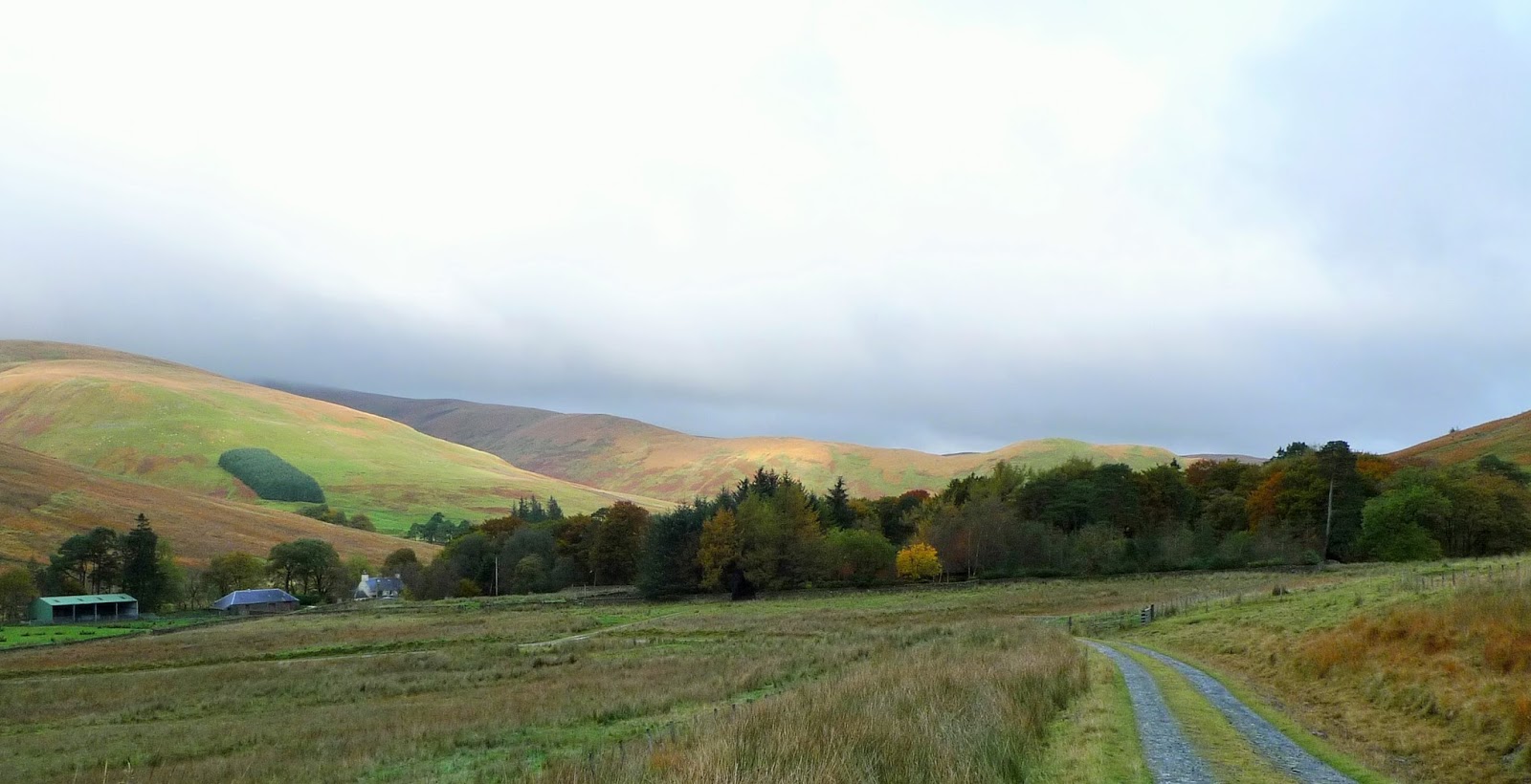
Firstly through the grounds of Blair Castle, taking Sustrans Route 7 Northwards ( This is the old A9) much of which I remembered from journeys up and down it as a child.
A feature of this long uphill drag was the headwind, this would be a menace for the much of the day. |
 |
| I left the tarmac at Dalnacardoch and headed up the Gaick Pass track...good going at this point, except for the wind. |
 |
| The double track finishes just beyond the ruinous Sronphadruig Lodge. |
 |
| The path is little wider than a sheep/deer track as it contours above Loch an Duin on its Western side. The narrow glen funneling the Northerly wind. This is remote country, you're a long way from tarmac hereabouts. |
 |
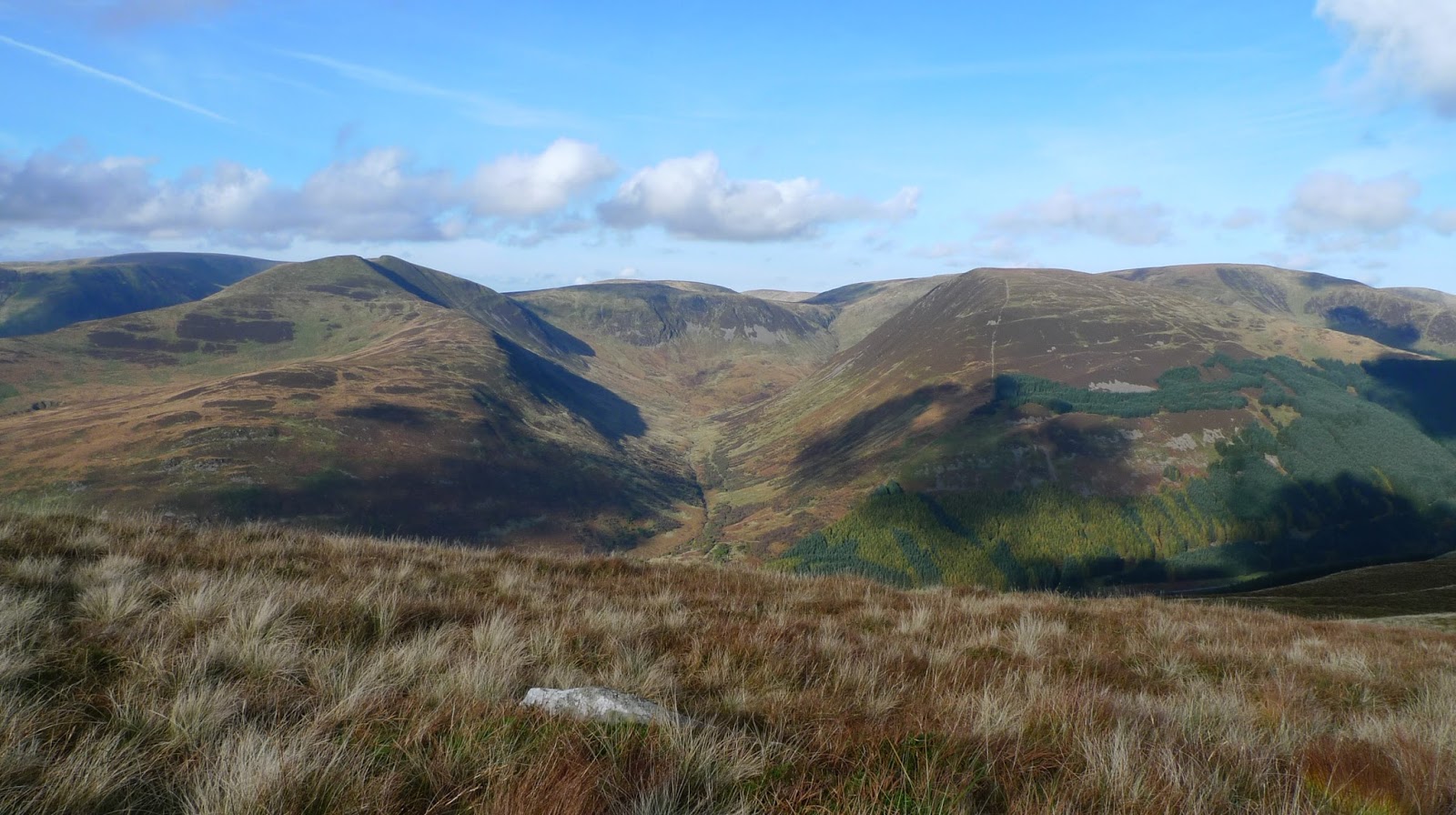
| The track improves again and the descent past Loch Bhrodainn and Gaick Lodge was easy going giving me the chance to take in the grandeur of my surroundings. |
 |
| Looking back from whence I'd come, tarmac and Glen tromie were just round the corner. |
 |
| Bhran Cottage, I was here in May on this years TGO Challenge...in alot of pain! |
 |
| Off road again at Drumguish as I headed over to Glen feshie, the weather was certainly as forecast. Warm and dry. |
 |
| Things certainly slowed down once I left Inshriach Forest and set off along the singletrack round Loch Gamha and Loch an Eileen |
 |
| Over to the Cairngorm Club footbridge, and some easier tracks round Loch Morlich. I was looking forward to some food at the shop near the campsite. It was shut!! a bit of a blowand I knew I was behind the rough schedule I'd set myself. |
 |
| The bar was open at "Glenmore Lodge" though. I had a soup and snack in the comfort of the bar and realised that getting to the Fords of Avon before nightfall wasn't going to happen. |
 |
| As I left "Glenmore Lodge" the cool of the evening hit me. I put plenty of effort in as I passed Lochan Uaine. Just past the junction to Ryvoan a reindeer hind and her calf wandered across the track in front of me. I could see lots of tents near Ryvoan Bothy...I hoped there would be space at the site of the old Bynack Stable...... |
 |
| I was lucky there was just 1 tent already there, I asked the guy if he minded me camping there....Ok "as long as I was Quiet"! He replied!! |
 |
| I slept well, hardly any surprise bearing in mind the effort I'd put in yesterday. The highest section of the Loop was next. |
 |
Its a long climb up over the shoulder of Bynack More, very little of the path is rideable...at least by me!
The views to the North compensated for my toils though. |
 |
| A short descent into Coire Odhar followed by a gentle climb to this point. Then its pretty much rideable down to and beside Loch a Bhainne. |
 |
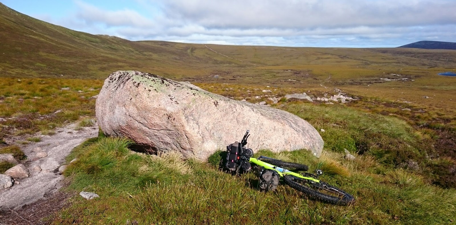
| Although these boulders weren't! Good view of the Barns of Bynack from here. |
 |
| Fords of Avon refuge...I'd never have got here in daylight, so a it had been a good decision to camp when I did. |
 |
| The river was low thank goodness, it was still well above knee height and dragging/pushing a bike through water that depth and strong flow is difficult. |
 |
The climb up to the top of the Lairaig an Laoigh was purgatory :-( it took an age...The only time on the trip I questioned my sanity.
Roughly in the centre of this photograph is the Hutchinson Hut for scale...Big Country! |
 |
The descent was great, almost all rideable if very technical.
Last time I was here these trees were behind a fence for protection from deer browsing, they've grown well. |
 |
The new footbridge at Derry Lodge, 2pm and it was time for a re-assessment of my goals. I was way behind now, with no real chance of finishing within 56hrs.
Time to take the pressure off and take an easier route back to Blair Atholl, and enjoy the moment. |
 |
| The heather was amazing, as good as I've ever seen it. |
 |
| I just touched the tarmac at Linn of Dee before heading out into the wilds again on my way to White Bridge and beyond. |
 |
| Socks off to cross the Geldie Burn, in hindsight I shouldn't have bothered it was so warm they would have dried quickly anyway. Beinn a Ghlo in the background, I'd soon be riding down Glen Tilt below its steep flanks. |
 |
| Upper Glen Tilt a lot of this is rideable although not all of it by any means. |
 |
| Fall of Tarf, I knew it was all good from here. Its not all downhill mind...not by any means! |
 |
Falls in Lower Glen Tilt.
From here I was soon back at the car at Old Bridge of Tilt. So the "Cairngorm Loop" had defeated me on this occasion. An earlier start by a couple of hours would have made a big difference I think?
I did of course complete " A Cairngorm Loop" and enjoyed 95% of the trip....the Hike-A-Bike up to Lairaig an Loaigh I could do without!
For those interested in my exact route a Strava log is here |