Showing posts with label Donalds. Show all posts

Wednesday, 22 May 2019

Hart Fell...In the Moffat Hills

So, having burnt some more fossil fuel, I found myself high in Annandale near Ericstane. Today's initial target was the Corbett of Hart Fell. From there I would see how I felt and how the weather fared. Parking near the community hall off I went....

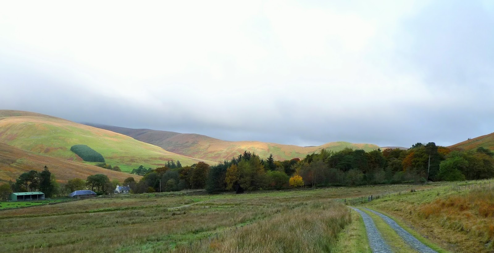
The hamlet of Ericstane and the head of Annandale

The Auchencat Burn which I would follow for the first part of my route.

The scree filled gully contains "Hartfell Spa"...next on the agenda.

This is the "Hartfell Spa" a chalybeate well, apparently good for curing ills...although the water looked like it would give you ills rather than cure any!

Things got a bit scrambley near the top of the gully

And here looking back down the gully towards Annandale. The prominent hill is I think Queensberry.

Lots of Mayflower about today.

Click on the image to increase the size otherwise you won't see all the wind turbines!
I have mixed feelings about them...there's an awful lot of them here though.

This is the subsidiary top of Arthur's Seat, to the left of the cairn in the distance is Skiddaw and over to the right of the image Criffel.

Yours trulyon the summit of Hart Fell gazing towards White Coomb.

It was a brutal descent beside the fence, out of view before climbing back onto the broad ridge in the middle of the photo...Whitehope Heights..a Donald.

Continuing beside the fence along the broad twisting ridge I joined the Annandale Way...marked by this cairn.

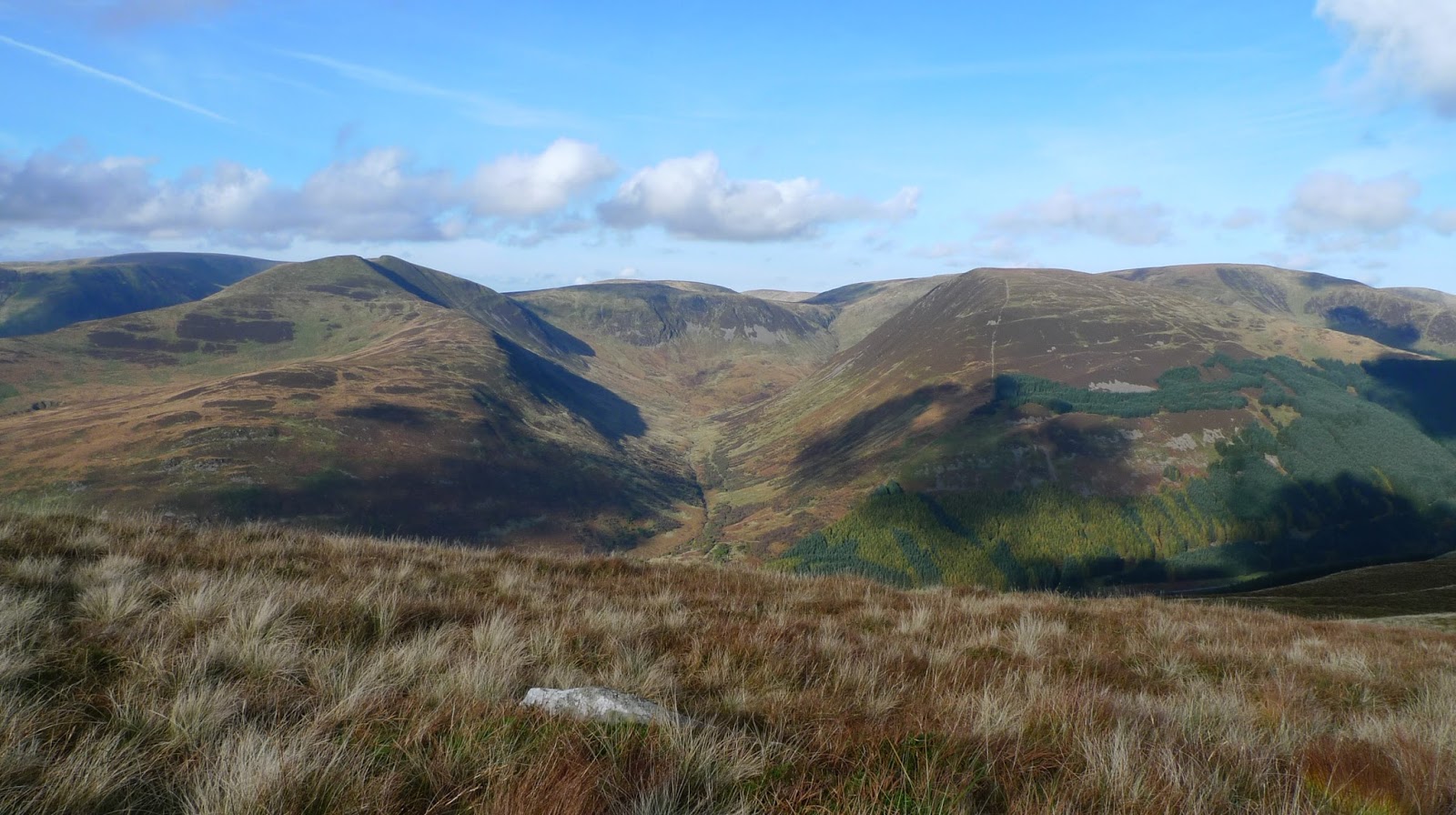
I stpped at the next col for a snack and drink, a great view down Annandale

Over my last top of the day Great Hill, I then picked up this great path which contoured under Strait Step. 

There were excellent views of the Devils Beef Tub from the path.
The path took me down to the valley floor at Corehead, from there it was road/Land rover track back to the car via Ericstane.
Superb weather, and a great horseshoe walk. Only one person seen (on Hart Fell summit) all day, quiet hills for sure.

Sunday, 11 June 2017

Tinto

The summit of Tinto
Today was the first of 4 days walking in Scotland. Originally planned as a Munro bagging trip! The weather forecast has not been good, indeed thunder storms were on the menu.
With this in mind I decided to do my hill walk further South. I climbed Tinto by the "tourist" path....and very popular it was as well.  The path from the Northeast made for an easy and quick ascent, just as well because it was very windy..,..and wet for most of the time.
Tinto is of course both a Graham and a Marilyn....so a double tick. Always good!
I did take some pictures.....but forgot the cable to transfer them to my tablet 😔 I will probably put something up on my return.
I'm at Crianlarich SYHA contemplating the best option for tomorrow....,.we'll see what the weather is doing in the morning is the current thought.

Wednesday, 10 May 2017

Marilyn Bagging in the Southern Uplands Part 3

Back at the car it was maps out again. I was intrigued by the hills I saw yesterday North of Broad Law, so decided on these 2 Marilyns. Culter Fell and Gathersnow Hill. A quick stop in Biggar to top up my food and then the short drive to Coulter and up beside the Culter Water to park just beyond Culter Allers Farm...

Heading up the Culter Water, the path leaves the road just beyond the second wood on the left

Looking back down the Northeast ridge of Culter Fell.

Next to the trig on Culter Fell, Tinto is the prominent hill in the background.

Theres a good fence to follow all the way to Gathersnow Hill, seen here just left of centre on the skyline.

The summit of Gathersnow Hill, the 2 streches of water are Talla Reservoir on the left and Fruid Reservoir on the right

The view back to Culter Fell

Looking to the West the hills are covered with windmills part of the massive Clyde Windfarm.
We all have our own opinions on these!

I took pretty much a beeline towards Culter Reservoir to pick up the well engineered track. this led down to the reservoir.

It was then about 3km of tarmac down beside the Culter Water back to the car. It was no hardship, the road is only used by a couple of cottages, farmer and the reservoir workers so was very quiet.
Back at the car, I got changed and it was off back home down the M74/M6.
A great trip very fruitful from a hill bagging point of view and good to back out under canvas...well Silnylon! All helped by the superb weather.

Wednesday, 26 October 2016

Backpacking The Ettrick Hills

This was a walk which had been on @ianwood2011 and my radar for quite a while. The weather window was Mon/Tues of this week, and after an easy drive up through the Eskdalemuir Forest we parked beside the Ettrick Water near Crook Cottage.

Last minute checks to make sure we haven't forgotten anything!

Glad to leave the tarmac and start to gain some height on the South side of the valley.

The fist summit of the day as we head Southwest...ish was Ettrick Pen, a Donald, Marilyn and Graham.

It had been dull and overcast since we'd left the car, but as we descended Ettrick Pen the sun was trying to break through. 

Ian on the Donald Hopetoun Craig, with Ettrick Pen receding into the distance.

Last summit of the day Wind Fell, not particularly windy...but very wet underfoot!

A knee punishing descent over pathless tussocks brought us to the col of Ettrick Head.
Take ggood notice you'll see a very similar scene later on!

Following the Southern Upland Way down into the valley to Over Phawhope, an MBA Bothy.
In very good order....lets hope it stays that way.

We were carrying tents but as the bothy was unoccupied (although a cyclist did turn up later) we decided to take advantage of the stove and stay inside.

After a decent nights sleep we woke to dense mist/cloud. But it soon became clear that higher the sun would be shining.

Sure enough the inversion tarted to appear as we headed back up to Ettrick Head.

Back at Ettrick Head and time for the climb to Capel Fell.

Ian looking back towards the Ettrick valley, still filled with mist.

From the summit of Capel Head the view to the North meant we could see the hills North of Moffatdale.

Meanwhile West was Croft Head.

Looking North into Black Hope, Hart Fell being the high point.

Our route lay generally Northeast, the next hill being the Donald Bodesbeck Law.

A stiff climb up pretty pathless terrain and the summit arrived, this is the view North.

The broad ridge undulates (lots of them) Eastwards towards Mid Hill.

The next Donald is Bell Craig, from here White Comb is the hill above Loch Sween across Moffatdale.  

This is the summit of Andrewhinny Hill, the last "listed" hill of our trip. Another Donald, Marilyn, Graham.

Before we descended back to the Ettrick Water, we walked over to Mid Hill (another one) and its ancient cairn.

Mid Hill's Southeast ridge led us unerringly back to the valley and the car.
Fortunately it had a quad track for much of the way which made for quicker progress.
It had been a great trip, we only saw 1 person and his dog on the hill 30km of solitude, the Southern Uplands deserve a better press we thought.