Monday, 28 December 2009

Ingleborough


A really frosty morning, much better than the forecast and we left a car at Ingleton, before driving on to Clapham. We made good progress up the walled lane to Clapdale, where we struck up following tracks in the snow, thank goodness! The sun was warm, it contributed to the heat generated as we plodded through the all covering whiteness.
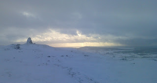
As arrived at Gaping Gill four cavers were setting off underground, Ingleborough seemed to tower above. Snow always appears to make mountains look higher. The path up onto Little Ingleborough was well compacted, so it was an excellent oppertunity to test my instep crampons. We stopped for lunch beside the large shelter on Little Ingleborough. The path onwards is level for about half a mile, as it steepened we turned left up towards a small outcrop which we scrambled up through the drifts to arrive on the summit plateau. It was busy near the cross wall shelter which we skirted to look down into Chapel-le-Dale. Following the edge anti clockwise to meet the Crina Bottom, we jogged down the path which was well banked up with snow we arrived at the farm. The snow thinned out a bit being replaced by lots of ice, half an hour or so and we were back at the car in Ingleton. A short drive over the old road past Newby Cote brought us back to Clapham.
The photograph is Ingleborough from Little Ingleborough.

Sunday, 27 December 2009

Canal Foot Ulverston


Just a stroll really along the shore from Canal Foot at Ulverston to the viaduct at Plumpton and back. Rare to see snow on the turf adjacent to the sea. After a buttie near the viaduct in a freezing wind and a chance to take a few pictures, it was back to Booths for a Hot Chocolate.

Saturday, 26 December 2009

Whitbarrow Scar


From the old A590 we walked along the footpath which traverses the south end of the scar. The old path Zig-zags up through the wood, eventually arriving at a relatively new cowshed, extremely well built in the style of a log chalet.
No cows to be seen although they could be heard! After a spot of lunch we continued on to the edge overlooking Witherslack with the views opening up to the Winster valley, and to the south, Morecambe Bay. The path was followed south along the ridge through the snow, finding the cows en-route, they seemed unperturbed by the snow.
A light shower passed by on the descent to the car, the snow had been very soft and slushy meaning my feet were very wet, I should probably throw the old Brashers, but I probably won't! Photo is of one of the many Silver Birch on the ridge.

Thursday, 24 December 2009

Merry Christmas


Oh yes its that time again! Merry Christmas to one and all.Its still all white hereabouts, family day tomorrow and then out on Boxing Day with the turkey butties for fresh air and exercise. A seasonal local photo is included.

Sunday, 20 December 2009

Around Farleton in the snow


I woke this morning to steadily falling snow, it looked like it meant business. After doing a few jobs the snow had eased and left about 15cm on the car roof! None of the roads are bus routes and are therefore left un-gritted. A walk from home along the canal and over Farleton Knott gave amazing scenes, a winter wonderland! It's very rare to see snow at all here never mind enough to stop almost all the traffic. An unusual Day. View is from the north top of Farleton Knott.

Monday, 14 December 2009

Coniston Fells


Sunday a great day, from Coniston an early start led up towards Coppermines valley, branching off to the right to gain height via the old quarrymans path to Tilbirthwaite. From the col the interesting path weaves between the rock outcrops onto Ladstones ridge, which I followed past the frozen tarns to the summit of Wetherlam. Always a favourite the views were good in all directions.
Here I met the first person of the day, I headed off to the west and after the short drop to the col I ascended Prison Band soon arriving at the summit cairn of Swirl How, again only one person on the top! My guess folks were otherwise engaged shoppin!
Along the ridge to Brim Fell and then Coniston Old Man. People about all over here and hereabouts! The descent to Goats Water hause was icy in places, although nothing to worry about, I was in trainers after all. The top of Dow Crag was reached in no time at all, lots of walkers of all ages here. An amazing vista the light was really good enabling Wales, the Isle of Man and Galloway in Scotland all to be seen. an easy promenade led to the track over Walna Scar, straight across and onto the thin path to White Maiden. This is a rarely visited top and all the better for it, it would make an excellent place for a bivi although water would have to be carried. Back to the pass over Walna Scar (the Hill) then down the Walna Scar road with the last rays of the sun on my back, losing it on the last mile to the car. 14 miles of pure pleasure.

Thursday, 10 December 2009

Bardsea


On my way to do my duty shopping in Barrow. A short walk along the shore in the sun, to the remains of the jetty at the foot of Red Lane for a spot of lunch. So good to feel the sun.

Cloud Inversion


Beautiful morning, coming down off Gummers How I was treated to the cloud inversion over Windermere with the Coniston hills in the background. Weather permitting I should be high on the fells over the weekend.

Sunday, 6 December 2009

Rydal Water


A better day at last, parked at Pelter Bridge and followed the bridleway to the shore of Rydal Water. The lake is still about 70cm higher than "normal", meaning a detour over the rocks to keep on track. Further on lunch was taken on Loughrigg Terrace, a convenient bench gave a good view of Grasmere and its surrounding hills. Back to the car via Rydal caves and a very washed out path! The river just within its banks at the bridge after the heavy overnight rain. The weather had behaved just a light shower at lunch. The picture is across Rydal Water to Nab Scar.

Thursday, 3 December 2009

Kentmere


After a morning spent winterising the motorbike the day seemed to be improving so a short drive to Kentmere, I parked near Ullthwaite bridge. Crossing the bridge and following the bridleway and footpaths to walk beside the old diatomite workings which became Kentmere Lake, I doubled back up the bridleway and into a sleet shower! From Whiteside End, Shipman Knotts and Kentmere Pike were clear but with a sprinking of snow/sleet.
The going all downhill now was very wet underfoot, the ground is really waterlogged. Back to the car through another rain/sleet shower. I'm looking forward to a dry day off, perhaps Sunday?
View is from Whiteside End looking NE.

Sunday, 29 November 2009

Arnside & Sandside


Yesterday the tops of the Lakeland Hills were covered with a light coat of snow, but that was yesterday and today its wet again! A slight clearance in the middle of the afternoon, I decided to go out round the local lanes on the road bike. a circuit of Hale, Gaitbarrow, Arnside, Sandside and back home via Beetham. Lots of water in the fields and the roads! The stiff NE wind gave me cold feet even with sealskinz on, it was never truly dry,but the fresh air was welcome and the views across the estuary good. Photo is of the Kent from the lane over Haverbracks

Sunday, 22 November 2009

Sour Howes and Sallows


Will the rain ever stop? In need of fresh air I drove to Moor Howe near Windermere, parked at the end of the Dubbs road. Wet when I left and still Raining when I got back!
Easy going up the recently renovated road to Dubbs reservoir, which is having some repairs done to the dam wall and spillway. Following Buckstone Barrow I was soon on the summit of Sour Howes, no view and no let up in the rain, so I pressed on to the top of Sallows. Again no view, a bit of backtracking then a pathless descent to the top of the Garburn track. the old road was followed back to the car at Moor Howe with the wind and rain blasting me in the face. Penetrating the Paramo jacket under the rucsack straps.

A good walk in spite of the weather. The photo is taken below Applethwaite quarry looking back towards the head of Troutbeck.

Thursday, 19 November 2009

Farleton Knott


Wow what weather, lots of rain leading to flooded roads over much of South Cumbria. Easier to walk from home today so a walk to the top of Farleton Knott, even the normally dry limestone was soggy with springs emerging from usually dry places. The view from the top wasn't great with Ingleborough, The Howgills and the Lakes hills all hidden in cloud. Only the near distance of Arnside, Silverdale and Morecambe Bay Visible. Lots of flooded land, with more rain forecast for tonight, already on the news many people have been flooded in the villages beside the River Kent. The photo is from near the summit looking east to the Barbon Fells. It managed to stay dry until I was nearly home.