Sunday, 31 March 2013

Kentmere Horseshoe

The view from near  Brockstones in Kentmere to the head of the valley.
 The sun was peaking out between the clouds, sadly this didn't last.

Looking South from just below the summit of Shipman Knotts.
Not much snow on these South facing slopes

North from Shipman Knotts, the way onward over Kentmere Pike

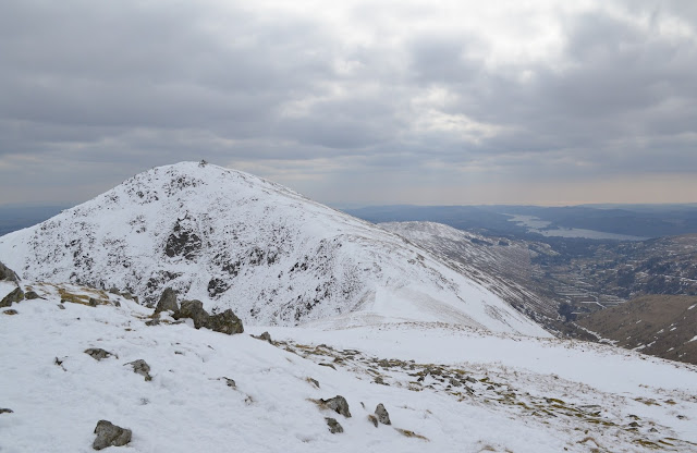
As I started to climb the broad Southern slope of Kentmere Pike the
snow became deeper. These are the drifts at the stile near Rough Crags

Kentmere Pike, and so far I hadn't seen anyone!

The Pennines seemed to be getting some more snow as I reached
Harter Fell. 

I had to use the Ice axe on the descent to Nan Bield, the frozen Small Water
was a distraction below.

Yoke, Ill Bell and Froswick seen from the descent to Nan Bield,
Kentmere Reservoir unfrozen.

The white wasteland that was High Street today. The wind was whipping
across the plateau making it bitterly cold.

Yoke, Ill Bell and Froswick from the wall on High Street.
Not much shelter behind the wall today.

South from Thornthwaite Beacon.

I met several largish parties on the ascent of Froswick. They were
struggling with the wind polished snow/ice. I had the better of it going
South. Just the climb of Ill Bell from here.

The Northern of the two lage cairns on Ill Bell, the Helvellyn range
over its shoulder.

The Southernmost of the cairns on Ill Bell, still no sun. Windermere Lake
glints from here, on a better day

Looking back at some of the hills I'd climbed earlier. All downhill from here.

Having dropped down to Garburn Pass I followed the track down into
Kentmere. This is Badger Rock much used by climbers for bouldering.
I just had to walk across the valley to the car, of course the sun
reappeared!

Friday, 29 March 2013

Pilling to Knott End

.
Today being a Bank Holiday it was time to find a quieter location for a stroll.
We parked at Fluke Hall Lane on the edge of Presall Sands.

The views from the sea wall were excellent, the Lakes, Howgills, Dales and
Bowland fells were all in view.  The photos don't do the day justice, they
seem to show a haze which actually wasn't there!

This is the foot ferry approaching Knott End, crossing the Wyre from Fleetwood.
The wind was behind us going....which of course meant it was blowing right
in our faces on the return.
Our walk today follows the Lancashire Coastal way and jolly good it was to.

Thursday, 28 March 2013

Whitbarrow Scar

I'd managed to con my mate Bill out for a short walk on Whitbarrow
Scar. This is looking North from the North end of the scar. I'm still recovering
from a cold, todays brisk walk in the bitter East wind certainly blew
 the cobwebs away!

Once we entered Flodder Allotment we found some shelter and sat in the
sun behind the wall to eat our butties.

As you approach Lords Seat there are a number of areas of limestone
 pavement. The stunted Yews and Juniper have a hard time of it up here.
No prizes for guessing from which way the prevailing winds come!

The impressive cairn on the highpoint, this is a cracking viewpoint,
all the Southern and many of the Eastern/Far Eastern fells on view.
For those who like to bag a peak or two this is a Wainwright
Outlier and a Marilyn I think.

We made our way back to the car along the maze of paths through
Township Plantation, to Row before dropping down to the car at the
 Lyth Valley Hotel.

Thursday, 21 March 2013

RSF ride to Grizedale


A fantastically clear day greeted me as I drove over to park at Chapel House Wood. I wondered if anyone else would take advantage of the super day, Norman arrived just before 10am, so I wouldn't be riding alone. After a bit of a chat we decided on the first leg of our route, and set off down the old road below the car park, crossing the busy A590 and riding along the quiet lane into Canny Hill.

Looking back to Canny Hill from the Bishops Allotment track

We doubled back onto the bridleway which leads over Bishops Allotment and eventually to Low Brow Edge. This was a great ride, neither of us had ridden this before (although I had walked part of it many years ago).

Entering Bishops Allotment?

At the end of the track we dropped down the road for a couple of hundred yards, before turning left to ride the bridleway which descends gently to Low Wood.

On the bridleway to Low Wood

Crossing the road we followed the cycle route which leads over the Roudsea Marsh and eventually crosses the Leven as it meets the sea.

Crossing the River Leven at Greenodd

We entered Greenodd under the A590, and then rode up the Crake valley, the Coniston Fells looking alpine with their covering of snow. The minor road on the eastern side of the valley made for easy progress, once at the hamlet of High Nibthwaite we were offroad again. 

Norman admiring the Coniston Fells on the Parkamoor track

The Parkamoor track climbs gradually in the main, although the couple of steep bits have been ravaged by offroad vehicles, a shame. 

Yours truly at Parkamoor

After a short discussion on the route we decided to ride North from Parkamoor, following bridleways all the way round the North end of the Grizedale valley. A found sheltered spot just before Moor Top for lunch, our route then crossed the tarmac and following forestry roads we made good time until just after Grizedale Tarn we took the bridleway which dropped steeply down towards High Dale Park.

Norman starting the descent into Dale Park

Only a few metres down the road, then a sharp left turn to take the bridleway over to the Cunsey valley, this track has suffered recently at the hands of the lumberjacks! Still mainly rideable though. The pleasent bridleway beside Cunsey Beck brought us onto the road beside Windermere. South now and after an easy section we had to climb the vicious hill of Baswicks over to Graythwaite. The "main" road towards Lakeside is almost all downhill, great!, Then off to the right into the village of Finsthwaite and after a gentle climb we turned onto the bridleway adjacent to Finsthwaite Hall. This was another track I'd never been on, it was another good track, through mature decidious wooodland.

On the "Finsthwaite Hall" bridleway

The bridleway brings you out just a couple of hundred metres South of Newby Bridge, all that remained was for us to ride back to the cars through Staveley-in-Cartmel. Norman thought we'd done about 31miles, we both agreed it had been a good ride.


Sunday, 17 March 2013

Arnside Knott

The trig on Arnside Knott


Just enough time today to have a walk over Arnside Knott. The weather a mixture of sleet, rain and hail showers. I'm getting bored of this Winter weather now! Nature is being held back by the cold, there is no sign of Spring round here.
We made the best of the day climbing over the Knott before descending to New Barns Bay, arriving just as the Bore was passing. We made our return to the car along the shore, stopping to watch the Coastguard carring out an exercise with their Jetski.

Sunday, 10 March 2013

Haweswater

The Rigg and Mardale Head through the snow

A circumnavigation of Haweswater today, the starting point being Burnbanks. This was the site of the purpose built village for the construction workers when the dam was built. A short section of Coast-to-Coast path brings you back onto the road to Mardale Head. In the past I've always used the permissive path on the  East side of the lake, however United Utilities have decided to close it. Or at least stop maintaining it and posting signs at all the access points to deter folk, Why??
As I made my way towards Mardale the snow came down driven in by a vicious Northeast wind, I knew that the return leg on the West shore would be into the wind. Through the blizzard I could hear geese on the lake and closer in to the shore there were several pairs of Goosanders. There wasn't many cars at Mardale Head, but as I walked round The Rigg I was met with the full force of the storm. The camera stayed in its waterproof bag for this section!

East from below Whelter crags

As I approached Measand the snow stopped and the sun came out, the views opened up at last. The wind still blew though! The lack of rain for the last couple of weeks meant that the falls weren't very impressive, but from here the view back to Harter Fell is excellent.

Harter Fell and Mardale head from Measand

From Measand the path undulates gently below the bracken covered slopes, crossing the aquaduct bringing water from Heltondale. Once past the dam the path descends to Burnbanks passing the new houses that were built in 2005ish to replace the "temporary" houses built in the 1930s. I got back to the car as the sun disappeared and another snow shower came blasting in.


Sunday, 3 March 2013

Askrigg and Mill Gill

Mill Gill Force

Todays short walk started at Askrigg in Wensleydale, inspired by the free parking mentioned by the Pieman (http://northernpies.blogspot.co.uk/2013/02/fourteen-miles-in-wensleydale-seven.html ). We walked up Mill Gill taking time to have a good look at the many pools, falls, and forces. The mature woodland has some fantastic beech trees as the path wends its way upward.
There is evidence of the water being harnessed by mills in many places, lots to interest the industrial archeologist hereabouts.

One of the many small falls

The highest waterfall is somewhat inaccessable, we did however by means of a bit of scrambling and trespassing get a good if precarious view. (sadly no photo worth keeping tho) We picked up Low Straights Lane which led us gently back downhill to Askrigg. 

Low Straights Lane

Although the sky had been overcast, it remained dry again. We're getting spoilt, the rain is forecast for later this week......perhaps they'll be wrong?