Wednesday, 25 March 2020

My Recent Thru Hike Gear Reviewed.....

......only joking! Anyway now I've got your attention....Here's some images from Social Distance walks 002/003/004. All taken within 2km from my home.

The Lancaster Canal and bridge no 154...I'm very fortunate in these troubled times, the canal towpath is within 10 metres of my home.

The River Bela and the rather grand but nameless footbridge, its a few hundred metres upstream of Hangbridge.

Reflections in the canal

Farleton Knott from the towpath

The M6 at 1.30pm today...there were trucks...honestly! People would seem to be finally heeding the Gov. advice/rules.

The lambs are growing up round here now...its less than 20 years ago that we suffered with Foot and Mouth. Thousands of stock slaughtered, and now its us humans who are threatened. 

Further along the canal and a different view of Farleton Knott...the swans will be constructing their nest. There are a couple of pairs between bridges 153 and 156. 

Bridge 156, lots of Celandine's enjoying the sun today!
This was as far as I walked today...I have only been out for an hour or hour and a half each day, and only seen anyone in the distance. The exercise and fresh air essential for a healthy body and of course ones mind.....more of that perhaps in a future post.
Well done if you've read this far, and sorry for the misleading title...there's method in my madness!

Sunday, 22 March 2020

Things are Changing....Social Distance Walk 001

No one will need any introduction to the situation we find ourselves in I'm sure. The stage we find ourselves with Covid 19 means the advice from our government is to not partake in any activity which would lead to transmission of the virus, do anything which would land you in hospital taking up a valuable bed and to travel only if necessary.
Therefore today I walked from home, a short trip in beautiful Spring weather up my local hill. Today even on this normally quiet hill there were dozens of people...many in groups...ridiculous!
The news this evening indicates that much stricter advice/rules will be introduced shortly...if some folk can't behave then no doubt we will all be confined to barracks....
There are no captions to today's images, if they give a little joy to anyone who is already self-isolating or simply can't get out in the outdoors at this time that would be great.
Take care everyone.....and don't forget...wash your hands at every opportunity, keep 2 metres apart,  wear gloves at stiles/gates etc and please follow the government guidelines when sneezing etc.


Wednesday, 4 March 2020

The Blencathra 2000'er's

Another 2000'er trip, with four hills on the agenda if all went well. I parked at Mungrisdale and followed the River Glenderamakin out onto the open fell. I'll tell the tale of the day by photos as is usual....
The Tongue prominent in this view, I would take the track to the left of The Tongue. Bannerdale Crags in the distance.

This path would be an easy one to walk on a compass bearing....straight as a die....and it takes you right onto the ridge.

An out and back leg allowed me to bag Bowscale Fell. Bannerdale Crags my next hill lay along what would normally be an easy trot across the broad ridge.

Some quite significant cornicing even on lowly Bannerdale Crags.

Looking back to Bowscale fell from the summit of Bannerdale Crags. It had been tough going the snow frozen...but not enough at this height to bear weight....a foretaste of what was come later...

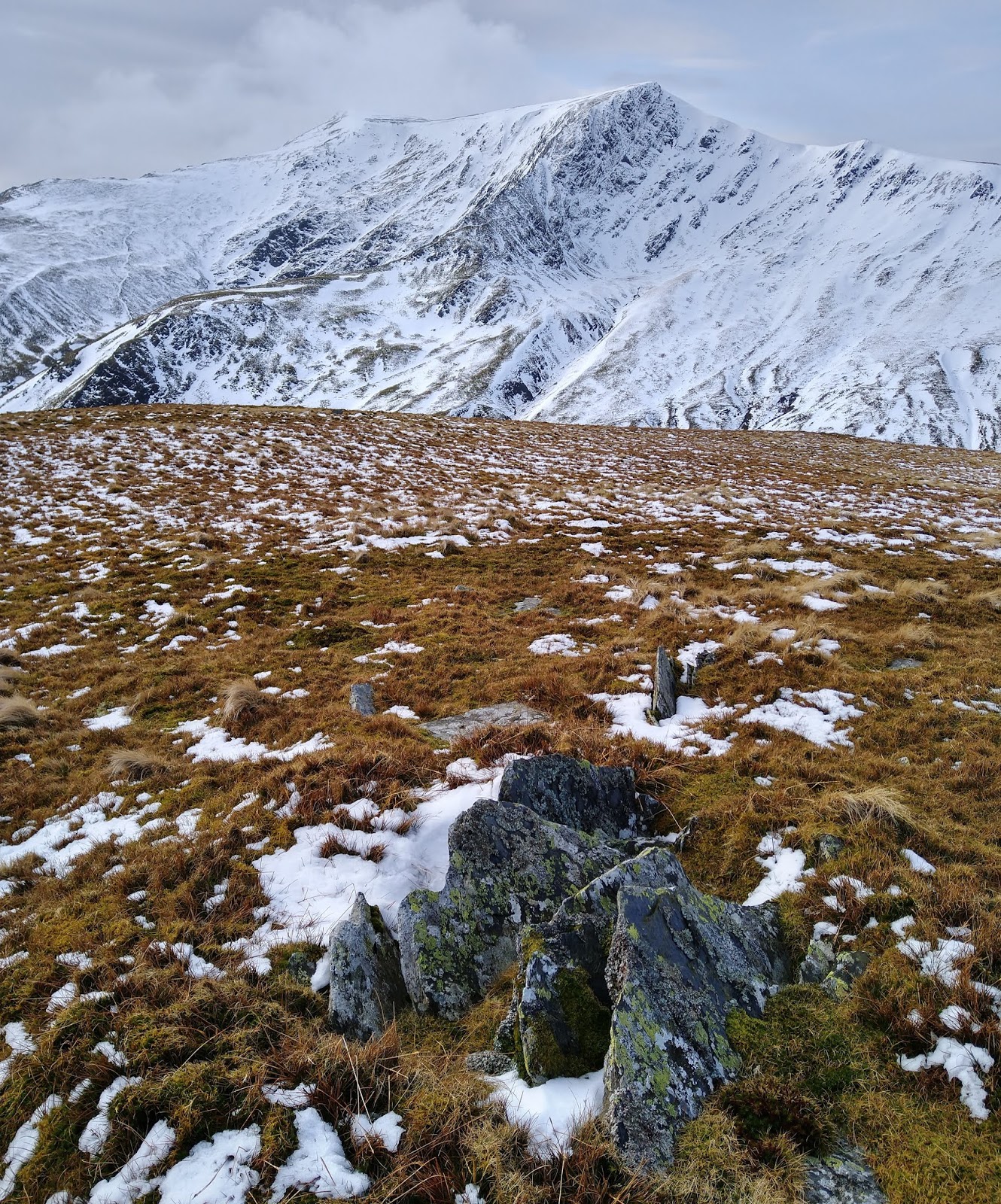
Blencathra in it's winter coat. Sharp Edge in the centre of the image. My route would be along the right-hand skyline.

Almost on the summit of Foule Crag and a superb vista of the Skiddaw group.

Summit of Blencathra, with it's unusual trig recently replaced after some halfwit stole the original.
Looking across to Clough Head and beyond to the South.

Huge cornices below Foule Crag, the near skyline is of course Sharp Edge.

Mungrisedale Common...I hesitate to call it a summit...it was my fourth and final hill of the day. The dark hill in the distance is Great Calva.
Old Wainwright must have had so many laughs thinking about all the pilgrims trudging across the wasteland to this point!...me included!!
Never again?
I suffered a complete sense of humour failure shortly after I took this photo, I had almost 2k of snow/ice to walk across...running was out of the question...it had all the structural integrity of flaky pastry...and most of it was cambered... bloody awful!

A last look back at Sharp Edge from the track below White Horse Bent in the upper Glenderamakin valley.
It should in theory have been an easy jog/run back to the car from here...and it was for a while.
I stopped to take my mini gaiters off, requiring removal of my trail shoes...I had an attack of really severe cramp in my right foot...agonising...no doubt brought on by the horrendous going across Mungrisedale Common. the last 3 miles turned into a bit of a hobble/walk/jog!
A great day in spite of this though. The Strava track and stats of the days exertions can be found here .

Wednesday, 26 February 2020

Harter Fell....Above Dunnerdale

I should probably have gone for a longer walk today. But Harter Fell was the last of the "outlier" 2000'ers...at least the way I've planned my campaign! I parked at the car park adjacent to Hinning House Bridge and set off to climb Harter Fell by the "trade route". A few photos from the day...

North from Hinning House Bridge and the slope of Grey Friar.

It's a steep pull to the fence....but very direct.
The Coniston Fells in the background.

The rocky summit...it was windy, I knew it would be the MWIS forecast said -20c windchill...it didn't feel anything like that to be fair. This was however another image taken from a prone position

One of the slightly lower outcrops, with a coating of rime.

Out of the wind and a different route back...a mistake as it happened, the snow was wet and slobbery from here on...2 falls, there was no cohesion between the snow and saturated boggy ground. Luckily I had a change of clothes in the car...no real harm done!

I picked up the bridleway which led South back towards Birks.
This photo looking down the Duddon Valley was taken from the "viewpoint" just off the bridleway.
Just a short jog back to the car from here.
As I said earlier this was the last of the "outliers", so with some better weather hopefully I will be able to really make some inroads into the rest of the hills on my list.
The Strava track and stats can be found here my advice would be not to use my descent route it was definitely "sub-optimal!!

Wednesday, 12 February 2020

Skiddaw Lower Man and Lonscale Fell

I cheated a bit with today's bagging trip, I parked at the top of the Underscar Road behind Latrigg! I justified this to myself with the thought that it was likely to be so wild and windy even attempting anything high in the conditions was a bit mad. Not the longest walk, but planned to leave me a grand round of the remaining Skiddaw hills for a better day. Not many photos, just keeping upright and my hands warm on the ascent was a challenge.

The Hawell monument beside the path shortly after you leave the car park.
The Helvellyn range behind...not much snow cover as you can see.

It was a struggle all the way up the path to Skiddaw Lower Man. The wind was ferocious and bitterly cold, MWIS was forecasting -13 windchill....it felt every bit of it.
I had to lie down to take this picture!

Rather than go back down the path I headed due East to pick up the Skiddaw path and found it a lot more sheltered. Once on Jenkin Hill I followed the fence and a rather feint path (for the Lakes) to Lonscale Fell. Seen here with the fence climbing it, easy going...I even had the wind behind me. 

Looking North from the summit of Lonscale Fell to Great Calva and Knott.
Almost all downhill from here....

....back to the col then down beside Whit Beck. Again another thread of a path..great!
I'm often told "you won't see much running rather than walking". But I can't agree...this was a fleeting scene with the sun lighting up Latrigg. Just this would have made the day worthwhile...of course there were another 2 hills bagged.
An easy jog/run back to the car. The Strava track/stats of my trip can be found here should anyone wish to check it out.

Wednesday, 5 February 2020

The Coniston 2000'ers

Today it was the Coniston fells that were my target. When I left the car on Bannishead Moor at the end of the metalled road I was unsure how many of the seven 2000'ers I'd collect. As is so often the case for me it was a late...ish start, and it seemed to be a lot more breezy than the MWIS forecast. I know these fells very well, and had a route in my mind....legs and lungs permitting!
It turned out rather well, there follows a lot of images...

Rather than climbing Dow Crag via Walna Scar, I decided to go up to Goatswater.
the cloud/mist was swirling round the crags high above.

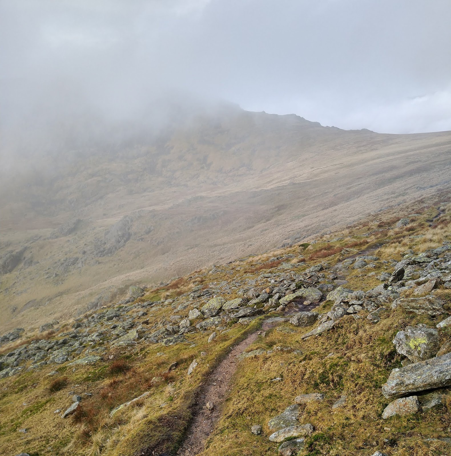
Goatswater Hawse in front...catching the cloud. It was the same when I got up there and all the way up to the Summit of  Dow Crag.

As we can see here, although the wind was trying to tear holes in the cloud...but mainly failing.

Back down to Goatswater Hawse I was in the cloud, and for most of the way climbing to Coniston Old Man. As I reached the ridge though the cloud was being ripped apart by the strong wind.
here we look South along the ridge to the "Old Man"

The trig on Coniston Old Man...and I had it to myself!
Time to turn round and head North along the ridge....

...to Brim Fell. Really easy to bag this one, virtually no ascent and good terrain for rapid progress.

Rather than add the climb over Great How Crags and Swirl How I took the traverse path round to the col between Great Carrs and Grey Friar known as Fairfield.

The summit of Grey Friar, and again the mist was trying to disperse...but not quite managing it.
A quick jog back to Fairfield (here in the mid ground). Then up over easy grass towards Great Carrs.

A brief stop at the memorial for the loss of a Halifax and all it's crew during the Second World War on Great Carrs. It's not far from here to....

...the top of Great Carrs. Here we look South..ish across Broad Slack with Dow Crag in the distance still in the cloud.

Again it's an easy walk/jog to here the summit of Swirl How.
Time for me to make a decision...to include Wetherlam or not? (Seen here to the left of the cairn)
I was feeling good, had loads of time and if anything the day was improving...still windy though!

The top of Wetherlam soon came into view, although the cairn seemed to have been destroyed.
Here we look back from whence I came...Great Carrs, Swirl How and Prison Band.
All I had to do now was get back to the car...with as little uphill as possible!

I headed back to skirt Black Sails and descend the wonderful grassy trod down the Blake How ridge to Levers Water. To arrive here at the head of Boulder Valley after a short ascent from the tarn.

Down Boulder Valley, past the Puddingstone and onto the long disused quarry road (where this photo was taken). It was then all downhill along the old Mandells quarry road back to the car.
A really good day, it almost felt effortless...12 miles..ish and 4 marvellous hours in my favourite hills.
My route and stats should anyone wish to check it out can be found here
If you've made all the way down here well done!...Cheers!