Friday, 22 May 2015

TGO Challenge 2015 Day 4 Mon 11th May

Faichimaird to Fort Augustus  15.9km - 267m ascent - 354m descent

I'd slept well again through the stormy night. But during the evening and again in the morning gave alot of thought to my route onwards from here, bearing in mind the poor forecast. I had changed my mind a number of times!! However as the primary reason for the next section of my crossing was to walk over Creag Meagaidh, and that looked unwise. My FWA didn't look to appealing either. So I decided on an easy walk up the Great Glen.


It managed to stay dry long enough to get the tent down in the dry amazingly.

But it wasn't long before the rain came on again...I was grateful for the shelter I was getting from the trees as I followed "The Great Glen Way" North.

There were lots of Primrose's and Violets to brighten the edges of the track.

Bridge of Oich, and the rain was really starting to come on. At least it was on my back :-)

I sheltered at Cullochy Locks with "The Chuckle Brothers"! I think the lockkeeper thought we were mad!

Kytra Lock, there wasn't much boat traffic on the canal... except here today

At Fort Augustus the rain eased off, I had booked a bed at Morags earlier in the morning. It was only about 1.30 when I arrived so called into the "Wee Neuk" for a burger,tea and scone.
I rang Challenge Control to say I'd changed my route and explain what my "new" route would be for tomorrow.It had been an easy day today and, I hoped to be back on my original route by tomorrow evening. Although it would require a long day.

Wednesday, 20 May 2015

Wold Fell and Galloway Gate

Today was the first "proper" walk since my early return from this years TGOC. The swelling has gone down at last and I'm able to walk without much pain! So my old mate Bill called to pick me up and we drove over to Dentdale. We had a rough plan to walk part of the Pennine Bridleway over Wold Fell and Galloway Gate

Up past Newby Head Viaduct which is as you can see scaffolded for repair

Off road at last on the Pennine Bridleway

Ingleborough from close to the top of Wold Fell

We passed the top of the Artengill track, which was an escape route if I didn't feel able to do the whole round!

But I felt good so carried on as we walked round the old drove track which is Galloway Gate

As the track turns Northward Swarth Fell and Wild Boar Fell came into view.
But for us it was back down past Dent Station into Dentdale and the car.
My leg felt good today, shouldn't be long before I'm back to full fitness!

TGO Challenge 2015 Day 3 Sun 10th May

Lochan (NN061983) to Faichimaird  30.9km - 573m ascent - 618m descent

I knew the forecast, so it was no surprise to be woken by rain hammering on the tent during the night. It was however dry when I woke and got the tent down in the dry. I took my time packing up, as I knew I'd was ahead of my schedule. The walking would be a lot easier today, down in the glens in the trees. I couldn't expect the expansive views of yesterday!

I hadn't even managed 1km before the rain came on firstly a dense drizzle then heavier more determined stuff. I'm always reluctant to get the camera out in such conditions....its rarely worth it.
This gorse gave some colour to a dull scene overlooking a widening of the River Kingie.

I took the opportunity of shelter under the forestry road across the River Kingie. Had I taken my FWA yesterday this would have been my camp spot..there were some good places to pitch.
After my snack I got back on the bridge to find that Martin Rye and Keith Willers were there. I knew our routes coincided here. We would walk together for the rest of the day.

This is the new bridge over the Allt Coire nan Saobhaidh, there is a new network of forestry roads some of them covering old tracks! What it does do is avoid dropping down to Garrygualach and back up. It saved us some time on the trek along Glen Garry

Keith and Martin on the new section of forest track, it had faired up for a short while. We never took our waterproofs off mind!

The view back West along Glen Garry, my guess is that this area must have been subjct to a forest fire at some point looking at the skeletons of the old Scots Pine trees hereabouts

Shortly before the Allt Ladadh we walked through a small herd of "Hairy Coo's". There were some very cute young calfs...mum was attentive but not aggressive. Might have been different had we had a dog with us tho! We stopped for a break in the old forest hut near the Allt Ladadh for a snack as the rain really came on increasing in intensity as we sat looking out from shelter.
From here to the campsite at Faicham the rain never let up at all if anything getting worse. It was good to be on a proper site under such conditions...I picked up my parcel (left by @ianwood2011 over the Easter Hol) I only put the fly up for a while to give more space for the inevitable sorting out!
The miles had passed easily today, really what I would describe as a transition day. The site had wi-fi so I was able to pick up a forecast and start thinking about the next day and beyond. The forecast was poor, even my FWA might not be suitable.

Tuesday, 19 May 2015

TGO Challenge 2015 Day 2 Sat 9th May

Sourlies to Lochan (NN061983)  25.5km - 2136m ascent - 2009m descent

This would be the hardest planned day of my Challenge, and in-fact I walked further than planned. I was pretty tired by the time I pitched my tent, after over 13 hours on the hills. It had been an excellent day, over some great mountains.

I'd slept well, and rose early...well early for me! The day looked exactly as forecast.

Loch Nevis was flat calm

I was away by 7am and took the stalkers path east. past the ruins of Finiskaig and climbed beside the Finiskaig River. 

I soon reached the junction of paths, my route heading into Coire na Ciche. There were lots of Red Deer everywhere (as indeed there were almost everyday) They grazed contentedly as I passed

Higher up in the coire the views opened up, the Corbett Sgurr na n-Aide dominating to the South

Reaching the col required a bit of scrambling...good job the snow had gone! 

I left my sac just above the col and climbed over snow and scree to the summit of Sgurr na Ciche. What a view, here to the West down Loch Nevis with Eigg and Rum in the distance

Northwest to Meall Buidhe, Luinne Bheinn with Ladhar Beinn and Beinn Sgrithall beyond

To the East, Loch Cuaich and some of the hills I intended to climb during the day. I was able to get some texts, including a weather forecast from Peter Dixon (@munro277 ) tomorrow would be wet!
I retuned to the col, having a chat with another Challenger Russell on the way down, he's on this picture (gives a bit of scale!) As I descended I weighed up the route up Garbh Choich Mhor, the next Munro

It's rough ground between the two Munro's, there is the remains of an old drystone wall to follow over this section. although some of it was under snow

Looking down the empty Coire nan Gall to Loch Cuaich. Sgurr Mor is the large hill in the centre of the frame...and my hoped for last top of the day

It's rough going all along this section of the ridge, Here on Garbh Choich Bheag Loch Nevis is still in view. In the foreground is part of the old drystone wall

There's some punishing descents and ascents but here on Sgurr nan Coireachan I felt I was making progress. There was a cool wind, so I sheltered just below the summit for a snack.
Sgurr na Ciche was starting to recede into the distance at last!

But there was still plenty to do...Sgurr Mor looks a long way away still!

Looking West ,Sgurr na Ciche has a superb profile 

This is looking West from Sgurr Mor back along the ridge I'd walked during the day...not sure it's backpacking terrain if I'm honest! Even with a light pack...I was only carrying approx 8kg and it still felt hard work!

On my last summit of the day, the Corbett Sgurr an Fhuarain. It would be all downhill for the rest of the day. 

Here we look East to the Munro of Gairich and across Loch Cuaich to the Munro's of Glouriach and Spidean Mialach. I had made the decision that rather than camping in the col below Gairich I would drop down into Glen Kingie with rain forecast. 

The evening sun was lighting up the Corbetts South of Glen Kingie. On the right Fraoch Bheinn and on the left Sgurr Mhurlagain. Ben Nevis and the Grey Corries in the distance had a lot of snow on them

It was an easy descent down the long East ridge of Sgurr an Fhuarain, then on the stalkers track which I followed down the glen.

I was struggling to find anywhere to pitch for a while, but in the end found a good spot next to the ruined croft of Lochan. I got the tent up at 8.30pm 13.5 hours after starting from Sourlies...a long day. Sleeping would not be a problem , it had been a long day but one of the best mountain days I've had in Scotland

Monday, 18 May 2015

TGO Challenge 2015 Day 1 Fri 8th May

Inverie to Sourlies  18.3km - 1099m ascent - 1099m descent

Well of course I started from Mallaig, but along with many other challengers I took the ferry to Inverie to actually start walking. This would be my second TGO Challenge and I was interested to see how it compared to last years. I had planned what my vetter described as a bold and adventurous route and was looking forward to 12 days trekking across the Scottish Highlands.
So on with the walk, a warning the post will be picture heavy :-))


Almost time to set sail and the Challengers are gathering!

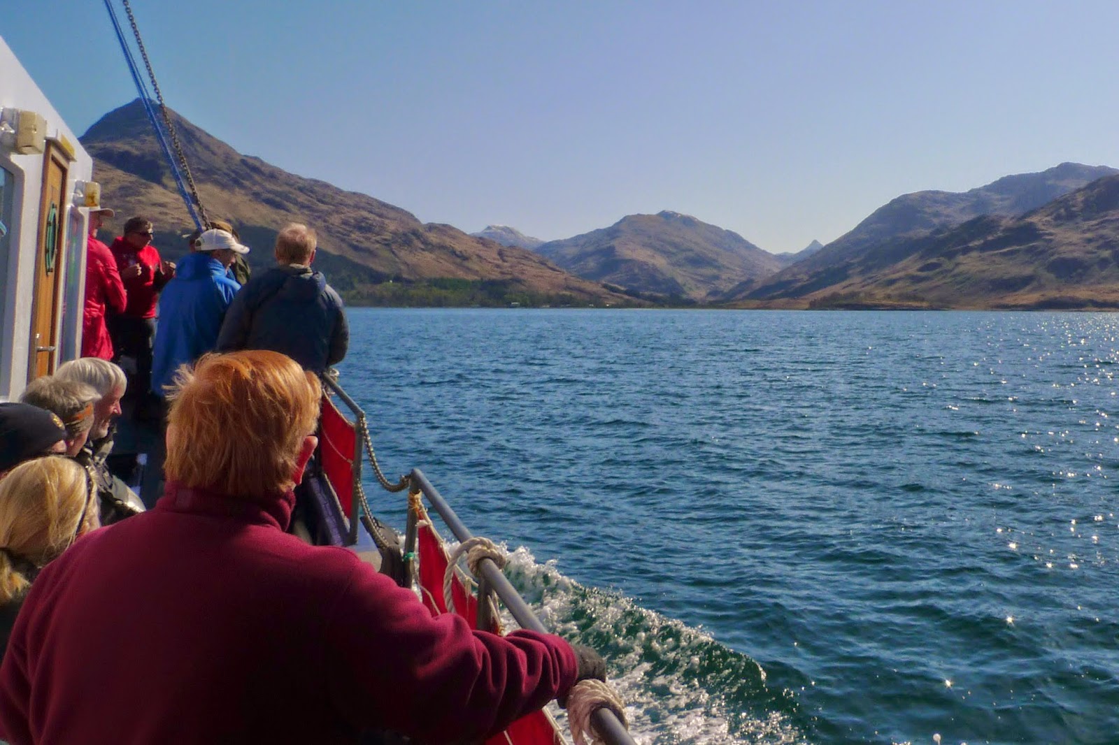
As we turned into Loch Nevis Eigg and Rum looked like they were floating under the cloudless sky 

Anticipation grew as the Knoydart peaks started to come into view.

We've landed and the walking can begin! Although a lot of challengers made a beeline for the cafe! Laggards!!

From the lower reaches of Gleann an Dubh Lochain it was still possible to see back to the "Small Isles" beyond Loch Nevis

I left the Barrisdale track and headed off up Gleann Meadail, the bridge below Torr an Tuirc had recently been renewed.. The stalkers path snaked away towards the col.

Once at the Mam Meadail I could see further into Knoydart. Sgurr na Ciche and Garbh Choich Mhor, two of the hills I intended to climb  next day. But first I had what looked to be the very steep climb to Meall Buidhe towering above the Mam Meadail.  

This is the view down Gleann Meadail  from just above the col, just as I was starting the ascent of Meall Buidhe

After a bit of huffing and puffing and grasping of grass! I arrived on the Munro top. The summit of Meall Buidhe just a sort way to the West.

Ladhar Bheinn was very prominent across Gleann an Dubh Lochain. Beyond is Skye and the Cullin Hills

Whilst turning round to look back along the short ridge to the "Rough Bounds", and hills as far as I could see!

I was soon back at the col, the zig-zag stalkers path made for a pleasant descent to the ruins at Carnoch. Haunted I believe?

Just below the ruins is the suspension bridge...swings a bit, but it'll last a while yet I'd say.

The flat ground between the bridge and the sea if bog supreme! IMHO there is no chance on this earth that you'll keep your feet dry across there in trail shoes. I walked the last few hundred meters on the sand, luckily the tide was out otherwise a detour over the headland is required.

Finally arriving at Soulies, the bothy is in a wonderful situation and is maintained by the MBA.
No one slept in the bothy although there were 6 tents outside, I thought there would be many more having seen how many folk got off the boat.
A great first day, in superb weather.